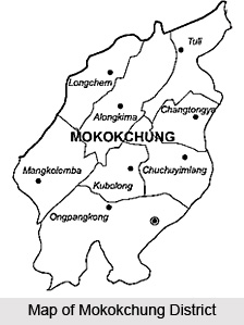
 Mokokchung District, an administrative district of Nagaland, is the home of the Ao Naga tribe. Mokokchung town is the district headquarters. This district covers an area of 1,615 sq kms. Mokokchung District lies between 93.53 and 94.53 degrees longitude and 25.56 degrees latitude. It is bounded by Assam in its north, Wokha District in its west, Tuensang District in its east, and Zunheboto District in its south. As per Census 2001, total population of Mokokchung District is 2,27,230 and literacy rate is 84.27 percent.
Geography of Mokokchung District
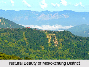
Geography of Mokokchung District comprises six distinct hill ranges. The ranges are more or less parallel to each other and run southeast direction. Between these ranges, there are gorges through which flow the hill streams. There are only two small valleys namely Changki and Tuli, and both of them are on the western side of Mokokchung District adjoining the plains of the Sibsagar District of Assam. The main ranges of this district are:
Tzurangkong Range: This range is adjoining the plains of Assam mostly along the valley of Dissai and Jhanzi Rivers. The climate of the entire range is warm.
Japukong Range: It is the outermost range stretching from north-east to south-west lying at the interior south of Tzurangkong Range.
 Changkikong Range: This range lies in the east of Japukong range.
Asetkong Range: It is a central range running from east to west but compared to the other ranges, it is the shortest one. This range lies between Melak and Menung rivers, and therefore, it resembles an island.
Langpangkong Range: It is the easternmost range skirting along the course of Dikhu River. The river forms a boundary line of Mokokchung with Tuensang and Mon districts.
Ongpangkong Range: It is the southernmost range forming an irregular boundary of the district. It is called Ongpangkong as the land is higher and cooler than the other ranges.
Soils found in Mokokchung District mainly include alluvial soil, non laterite red soil and forest soil. Geography of Mokokchung District also comprises some major rivers apart from the ranges and these are Melak, Dikhu and Tsurang.
Culture of Mokokchung District
Culture of Mokokchung District is mainly tribal in nature as this district is mainly inhabited by the Ao Nagas. There are 93 villages of this tribal community on Mokokchung District. The Ao`s belong to three dialectical groups, namely, Chungli, Mongsen and Changki. Other communities have also settled in Mokokchung District. Ao tribe is one of the major tribes of the Naga family.
Major portion of the total area of Mokokchung District is under cultivation. Rice, Maize, Soya Beans, Pea and Mustard are the major crops cultivated in this district of Nagaland.


