 There are several important Water Projects in India that were built as multi-purpose projects, with the aim of not only providing water to the towns and cities but also to generate Hydel-power. With the advent of the 20th century, a new era of developing water projects for generating Hydro-electricity in India began on a modest scale. After Independence there has been a sharp burst in developing hydro-electricity in various parts of the country. From this time, India has been engrossed in projected economic activities to attain self-sufficiency and improve the quality of living of its citizens. Amongst the various actions that followed for this intention, dealing with water resources has been one of the primary aims and therefore, developing water projects in a larger scale gained importance. To control the twin problems of flood and famine and also to generate Hydro-electricity in a larger scale developing and maintaining water projects in India became a prime concern. Although the main aim for developing the water projects in India was indeed to generate Hydro electric power; however, providing power to the cottage industries, medium and major industries also became an imperative part of the objective of the water projects in India.
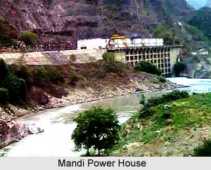
In the year 1902, India witnessed the first Hydel-power house on the River Kaveri in Sivasamudram, Karnataka. However, it was just the beginning and almost immediately Tata Hydroelectric Scheme in the Western Ghats of Maharashtra, to furnish power to Mumbai, was established. Pykara was marked as the first water power station in Tamil Nadu. Water Projects in India followed even in the Northern part of the country and Mandi Power House was the first one, developed in the Himalayan region. The next one in the pipeline was the Upper Ganga Canal Hydroelectric Grid System.
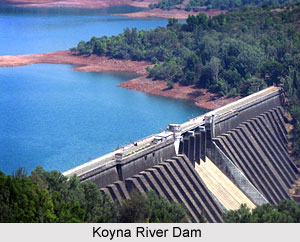
 The water projects of India are also the part of the several multi purpose projects. One of the illustrious water projects in India is the Rihand Project. This is the largest man made lake in India, on the fringes of Madhya Pradesh and Uttar Pradesh. Its capacity is 300 mw each year. The Koyna Project in Maharashtra is another important water project in India and is constructed on an east flowing tributary of the River Krishna. A dam on the Koyna River has been built only to ferry waters through a tunnel to the western slopes of the Ghats. Its capacity is 880 mw and it provides power to the Mumbai-Pune industrial region. The Sharavathy Project, another important water project in India is located in the Jog Falls in Karnataka. Its total capacity is 891 mw. It serves the Bengaluru industrial region and also furnishes the states of Goa and Tamil Nadu. The Saharigiri Project in Kerala, The Balimela Project in Orissa and the Salal Project for Hydro-electricity in Jammu and Kashmir are other important water projects in India.
In addition to these power projects, India has also built a gigantic Hydel power project in Bhutan at Chukha, which was financed by India. The excess energy is brought by India for its use in the north-eastern parts of the country, including West Bengal. The National Hydroelectric Power Corporation Ltd, (NHPC) was established in 1975. It has added 2133 mw raw Hydel power since then. These encompass- Chamera Stage I, Uri, Salal Stage I, Baira-Siul, Loktok, Tanakpur.
With the evolution and development of technology, and with the growing demand for water and energy, along with the growing Indian population, more such Water Projects in India are being planned by the government.


