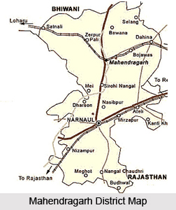
 Mahendragarh District is one of the 21 administrative districts of Haryana and is situated in the south western region of the district. Mahendragarh District was earlier known as `Kanaud` because of its association with Kanaudia group of Brahmans. During the middle of the nineteenth century, it came to be known as Mahendragarh. Mahendragarh District is one of the 21 administrative districts of Haryana. Narnaul town is the district headquarters. Total area occupied by Mahendragarh District is 1,859 sq kms. As per 2001 Census, total population of the district is 812,022. Mahendragarh District has two sub divisions namely Narnaul and Mahendragarh. The five development blocks of the district are Nangal Choudhary, Narnaul, Ateli, Mahendragarh and Kanina.
History of Mahendragarh District
Although the nomenclature of Mahendragarh District is not very old, the antiquity of the area it covered can be stretched to earlier periods also. The Archaeological explorations conducted in the region have brought to light late Harappan sites especially from its Rewari tehsil. Most of the sites explored in the district belong to the late-medieval period. However, it has been suggested that some of the present streams of the district may be identified with those mentioned in early Vedic literature. The succeeding stages in the historical growth of the district cannot be traced in because of the absence of concrete evidences.
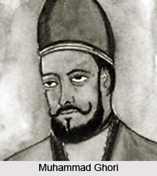
 Possibly it was included in the empire of the Mauryas, the Guptas, and the Gurjara- Pratiharas. After the death of Muhammad Ghori, one of his generals, Qutub-ud-din Aibak, laid the foundations of the Turkish rule in India in 1206.
Further, after Firoz Shah`s death, Mahendragarh along with other adjacent territories went out of the control of the Tughlaqs. The Sayyids after Tughlaqs, tried to bring the district under their control, but they also seem to have achieved little success. Soon after establishing his rule in northern India, Babur brought the district under his effective control. Humayun, who succeeded Babur in 1530, made no change in the existing administrative arrangement. Sher Shah was an administrative genius. He divided his whole kingdom into sixty six sarkars. Mahendragarh came under the sarkars of Narnaul and Rewari. Sher Shah ruled for only five years (1540-45). After the death of Aurangzeb, the district`s position changed drastically. In 1750 Raja Madho Singh of Jaipur seized a sizeable territory in the district around Narnaul and Kanaud. In 1792, the Maratha chief Mahadji Sindhia succeeded in capturing the district. The British rulers too reached Rewari. With the launch of Non Cooperation Movement by Mahatma Gandhi, the struggle became still more intense. In 1930, the Civil Disobedience Movement was launched by Mahatma Gandhi. The district contributed heavily in the country`s freedom struggle.
After India achieved independence, Mahendragarh district along with the other districts of Patiala State formed part of the Patiala and East Punjab State Union (PEPSU) in 1948, which merged with Punjab in 1956. Haryana was carved out of Punjab in 1966 and Mahendragarh became the district of the new state.
 Geography of Mahendragarh District
Mahendragarh District is surrounded by Bhiwani District and Rohtak district on the north, by Rewari district and Alwar district of Rajasthan on the east, by Jaipur and Sikar district on the south, and by Sikar and Jhunjhunu district on the west. The xerophytic type of flora dominates the district. The district is inadequately wooded and some parts are practically bare of trees. Mahendragarh District is inhabited by various groups of mammals. The district is also inhabited by large number of birds which add beauty to the wildlife.
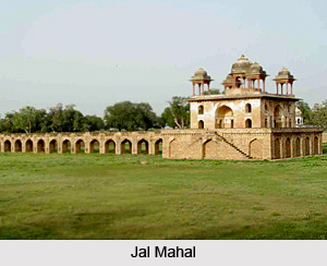
Mahendragarh District has several historical and religious sites that are worth exploring. Jal Mahal, Birbal Ka Chhatta, Tomb of Shah Wilayat, Chor Gumbad and Chamunda Devi Mandir are some of the main attractions of Mahendragarh District.


