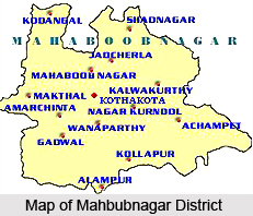
 Mahbubnagar or the Mehboobnagar district of Telangana is also known as Palamooru. Mahbubnagar town is the district headquarters. The district ranks second in the state of Telangana in terms of land area. The location of the district is strategic in the sense it is located only at a distance of 96 kilometers from the state capital Hyderabad. Mahbubnagar has been divided into 64 mandals under 4 Revenue Divisions.
History of Mahbubnagar District
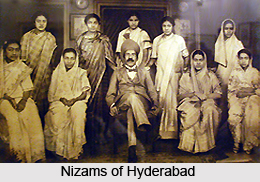
The early name of the district was "Rukmammapeta" and "Palamooru". The name was changed to Mahbubnagar on 4th December, 1890 in the honour of Mir Mahboob Ali Khan, who had remained the Nizam of Hyderabad from 1869 to 1911 AD. The Mahbubnagar district was also known as Cholawadi or the land of the Cholas`. Historical record says that the famous Golconda diamonds including the Kohinoor diamond was obtained from this district.
 The district of Mahbubnagar had been ruled by the Satvahana Kings and the Chalukya Dynasty in the early days before the district came under the rule of the Qutub Shahi Dynasty followed by the Nizams of Hyderabad. At this juncture it may be mentioned that Mahbubnagar has witnessed several invasions and ruins of temples and those ruined structures are still present in the area as historical evidences.
Geography of Mahbubnagar District
The global position of Mahbubnagar district is on 16.73 north latitude and 77.98 east longitudes. Nalgonda and the Guntur districts stand to the east of Mahbubnagar. On the west it is bounded by the Gulbarga district of Karnataka. The Rangareddy and the Kurnool districts are towards the north and the south of Mahbubnagar respectively. Mahbubnagar occupies an area of 18,432 square kilometers. The district of Mahbubnagar is generally divided into two distinct regions. They are the plain region with low lying and scattered hills and the second is the plateau of Amarabad-Farhabad. The plateau region has a continuous range of hills with an average height of 800 meters.
 The two important rivers that flow across the district of Mahbubnagar are River Krishna and the Tungabhadra River. An important feature of the climate of Mahbubnagar is that it faces drought conditions which occur due to the scanty and erratic rainfall in the region. The average annual rainfall of the district is 604 mm. Timber trees like ebony, teak, mango, tamarind are commonly yielded from the forests of Mahbubnagar. Apart from the timber trees the forests also yield plants which can be used as fuel wood. Hence it can be said that the geographical conditions of the area does not assist the growth of a lot plants and trees.
Demography of Mahbubnagar District
The population of the district in the year 2001 was 3,513,934. The density of population in the district is 167 persons per square kilometre. Most of the people in the district dwell in the rural areas and only a meager percentage of the population which is equal to 10.57 percent stay in the urban areas. The sex ratio in the district is 973 females per thousand males.
Telegu is spoken by more than 90 percent of the people in Mahbubnagar and only a very few of them speak in the Urdu Language. Literacy rate in the region is as low as 44.44 percent. Similarly the percentage of working population in the district is 43.19.
Culture of Mahbubnagar District
The people of Mahbubnagar district are very hard working and their life style is still comparable with that of the slaves. Due to severe drought conditions in the district the people migrate to outside regions and the people of Mahbubnagar are known as cheap source of labour in the country. The economic and the educational conditions of the Mahbubnagar district are yet much backward. It is true that they have to suffer a lot of difficulties yet music is an integral part of their lives.
Education in Mahbubnagar District
The academic institutes of the Mahbubnagar district falls under the jurisdiction of the Osmania University. In addition to the various government colleges and institutes which offer undergraduate and post graduate degrees there are several private institutes in the region which cater to the academic needs of the students. Some of the well known private academic institutes of the district are SVS Medical College, Madina Group of Institutions, Jaya Prakash Narayana Engineering College and a lot more which adds to the prestige of Mahbubnagar.
Economy of Mahbubnagar District
The prime occupation of the people of Mahbubnagar is agriculture. But due to frequent droughts which are caused in Mahbubnagar, several farmers are not able to carry out their agricultural activities in a proper manner and as a result they migrate to the nearby towns. The main crops that are grown in the region are paddy, castor, pulses and jowar. The main industries of the district are cotton textiles, power generation and ceramics. Horticulture is also an important occupation for the people of Mahbubnagar. The fruits that are commonly grown in the district of Mahbubnagar are mango, sweet lime and orange.
Tourism in Mahbubnagar District
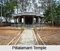
The district of Mahbubnagar has been made a picturesque location with low as well as high hills surrounding the district all around. Apart from the beautiful view there are some places of tourist attraction in the district. They are namely Pillalamarri, Srisailam, Alampur temple, Koilsagar Dam and Priyadarshini Jurala Project at Gadwal.


