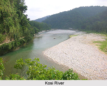
 Madhepura District is one of the 38 administrative districts of Bihar and it has its headquarters located at Madhepura town. Araria and Supaul District surround Madhepura District in the north, Khagaria and Bhagalpur districts in the south, Purnia District in the east and Saharsa District in the west. It is situated in the plains of Kosi River and located in the north-eastern part of Bihar at longitude between 25 degree 34 minutes to 26 degree 7 minutes and latitude between 86 degree 19 minutes to 87 degree 7 minutes.
History of Madhepura District
History of Madhepura District is traced back to the reign of Kushan Dynasty of Ancient India. The "Bhant Community" living in Basantpur and Raibhir village under Shankarpur block is the descendents of the Kushan Dynasty. Madhepura was a part of Maurya Dynasty; this fact is asserted by the Mauryan pillar at Uda-kishunganj. Singheswar Sthan has the religious significance since ancient time as this land was the meditation place of the great Rishi, Shringi. Madhepura District had got the status of subdivision in the year 1845 in which there were seven blocks. When Saharsa became a district in the year 1954, Madhepura became its subdivision. Madhepura subdivision, which had seven blocks at that time, was given the status of a district in the year 1981. On 21st May, 1983 Uda-kishunganj Block was upgraded and made a subdivision of Madhepura District in the name of Uda-kishunganj. Besides seven old blocks, four new blocks came in to existence in the year 1994. There were Gwalpara, Puraini, Bihariganj and Shankarpur. First thee blocks come under uda-kishunganj subdivision and last one is under Madhepura subdivision. Later on two more new blocks were constituted in the name of Ghailar and Gamaharia, under Madhepura sub-division in 1999.
Geography of Madhepura District
The maximum temperature of this district ranges from 35 to 40 degree Celsius and the minimum temperature varies from 7 to 9 degree Celsius. The average rail fall in this district is 1300 mm. Total area of land for cultivation is 1, 36,646 Hectare. Proper irrigation facilities are available in Madhepura District. The total number of state tube wells in the district is only 31. No big industry has been set up in the district.
 Demography of Madhepura District
According to 2011 Census, Madhepura District had population of 1,994,618 of which male and female were 1,042,373 and 952,245 respectively. The population of Madhepura District constituted 1.92 percent of total population of Bihar. If things are looked out at gender wise, the male and female literacy rates were 63.82 percent and 42.75 percent. The total literates in Madhepura District were 858,886 of which male and female were 533,342 and 325,544 respectively.
Education in Madhepura District
There are about 834 Govt. schools are imparting education in the district. Bhupendra Narayan Mandal University is situated at Madhepura town and enhancing the educational system of Madhepura District.
Tourism in Madhepura District
Tourism in Madhepura District includes several sites of religious and historical importance for the travellers to explore. Like for instance, the main attractions include Singheshwar sthan is a famous pilgrimage of Lord Mahadev in the country. It is situated at a distance of 8 km from Madhepura town and is renowned for its historical and religious importance. Another attraction is Nayanagar Durga Sthan situated at the distance of 11 km from Goalpara Block headquarters and at a distance of 35 kms from Madhepura district headquarters. These places of interest attract people from different parts of the country.
Paddy, Wheat, Maize, Jute, Oil Seeds and Pulses are the main crops cultivated in Madhepura District.


