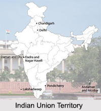
 Indian Union Territory, defined as the “sub-national administrative division of India†is directly ruled by the Federal National Government. The Union Territories are therefore under the domination of direct administration and control of the Federal Government of India. The President of India nominates an Administrator or Lieutenant Governor for each Territory.
Formation of Indian Union Territories
When the Indian Constitution was adopted in 1949, there was only one Union Territory; Andaman and Nicobar Islands. The National Capital Territory of Delhi, Chandigarh and Lakshadweep were formed by separating each territory from pre-existing states. Dadra Nagar Haveli, Daman and Diu and Puducherry were formed from acquired territories that formerly belonged to Portuguese India or French India.
Indian Union Territories
The 7 Indian Union Territories are:
1. Andaman and Nicobar Islands
2. Chandigarh
3. Dadra and Nagar Haveli
4. Daman and Diu
5. Lakshadweep
6 Delhi
7. Puducherry
 Andaman and Nicobar Islands, Indian Union Territory
Andaman and Nicobar Islands are described as the Tourist"s Paradise. It lies in the Indian Ocean and comprises of two islands namely, the Andaman Islands and the Nicobar Islands. These Islands separate the Andaman Sea to the East from the Indian Ocean. It is one of the important Indian Union Territories. Its capital is Port Blair. It is situated in the Indian Ocean, and has more than 570 islands. Formerly, the British used them as an isolated prison for the fighters of Indian Independence. However, these "Emerald Islands" are a famous tourist destination. It is also famous for the active volcano, known as "Barren Island".
Chandigarh, Indian Union Territory
Among the Indian Union Territories, the name of Chandigarh deserves special mentioning due to its unique functioning. Being the capital of two states, namely Punjab and Haryana, Chandigarh still is not under the jurisdiction of either state. Rather it is under the control of the Central Government and hence is regarded as Union Territory. It is the richest city in India with a per capita income of Rs.67,370 and Chandigarh has the largest number of vehicles per capita. Chandigarh is also known as "Shopper"s Paradise".
Dadra and Nagar Haveli, Indian Union Territory
Dadra and Nagar Haveli is described as the "land of natural beauty". There are four industrial estates in the territory. Among the Indian Union Territories, Dadra and Nagar Haveli are situated in the western region of India, Silvasa is its capital city and "Lieutenant Governor" administered it. It is located on the northern banks of the Daman Ganga River. The inhabitants took up manufacturing as their main occupation, thus constituting a considerable proportion of the economy of the region.
Daman and Diu, Indian Union Territory
Daman and Diu is the second smallest among the other Indian Union Territories, with its two distinct parts, enveloped between Arabian Sea and Gujarat. Daman is situated near Surat and Diu is located near Junagadh. The territory was ruled by the Muslim Emperors for 200 years. The 16th century marked the arrival of Portuguese in Goa and they ruled this beautiful state and the surrounding area for over 450 years.
 Lakshadweep, Indian Union Territory
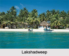
Lakshadweep is the smallest Indian Union Territory, situated in the Arabian Sea. It consists of twelve coral atolls, three coral reefs, five banks, and numerous islets, and is under the jurisdiction of Kerala High Court. The capital of this Union Territory is Kavaratti. The main islands are Kavaratti, Agatti, Amini and Minicoy. It is a land of lagoons, its exquisite underwater life perplexes viewers and tourists. Though smallest in area, the Union Territory of Lakshadweep has tremendous economic potentialities because of its vast economic zone. Agriculture is the main economy here.
Delhi, Indian Union Territory
Delhi, called the National Capital Territory (NCT) has the political status of a "federally-administered" Union Territory. A constitutional amendment in 1991 bestowed upon Delhi a special status. Delhi has its own legislative assembly with restricted powers. The National Capital Territory of Delhi comprises 9 districts, 27 tehsils, 3 statutory towns viz. Municipal Corporation of Delhi (MCD), New Delhi Municipal Committee (NDMC) and Delhi Cantonment Board (DCB), 59 census towns and 165 villages. National Capital Territory of Delhi is an important commercial centre in South Asia. Delhi has a per capita income of 53,976 INR which is around 2.5 times of the national average. The major service sectors of Delhi are information technology, telecommunications, hotels, banking, media and tourism.
Puducherry, Indian Union Territory
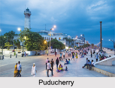
Puducherry is known as the mystic city which has a cosmopolitan setting. Puducherry is known as the "Window of French Culture". Since it was under the dominance of French Colony, French influence is quite prominent even in the contemporary period also. The whole city can be distinctly divided into two sections: the French quarter and the Indian quarter.


