Home > Travel > Hill Stations in India > Lakkidi - Kerala
Lakkidi - Kerala
Lakkidi is hill station in Wayanad District of Kerala. This hill station in Kerala has the deep valleys, mountains and the breathtaking roads.

Share this Article:

Lakkidi, Wayanad District, KeralaLakkidi is the hill station and the gateway of Wayanad district of Kerala. This hill station in Wayanad District of Kerala has the second highest range of rainfall region.

Location of Lakkidi
Lakkidi gets the second highest degree of rainfall in the world. Lakkidi is one of the highest locations in Wayanad. It is situated 700 m above mean sea level, atop Thamarassery ghat pass. Vythiri is the nearest town, just 5 km from Lakkidi.

Geography of Lakkidi
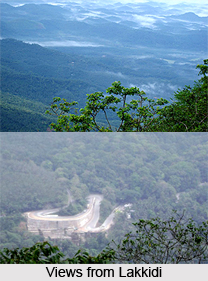
The lofty mountain peaks, the gurgling stream, luxuriant vegetation and the bird`s eye view of the deep valley on the south, with its winding roads, are breathtaking. Three kilometres from Lakkidi is the Pookot Lake, the natural fresh water lake, very wide and deep, one of the rare reservoirs of water in Wayanad. Lakkidi is surrounded on all sides by meadows and hills which made its a favourite picnic spot.

Climate of Lakkidi
Lakkidi has a heavy rainfall averaging 600-650 cm annually. It is one of the richest biodiversity areas in the Western Ghats Mountain Range in India. There are a number of species including lion tailed macque, rare birds, Indian Shag (phalacrocorase fuscicollis), Little Cormorant (Phalacrocorax Niger), Little Green Heron (Ardeola striatus ), and Pond Heron (Ardeola grayii) . Lakkidi is a true rainforest along some deciduous forests in the Ghats section of Wayanad so rains starts in May and ends in December, due to the rainfall and beauty it is often called "Chirapunjee of Kerala". It has an average rainfall ranging from 600-650 cm or above. It experiences chilly climate throughout the year with mist and fog. It is said to be coldest place in Wayanad district as well as one of coldest in Kerala. It enjoys highland climate. Generally monsoons come with torrential rainfall and windy weather

Soil of Lakkidi
Lakkidi has highly rich soil with an average height of 700 m above sea level thus forming one of highest mountains in Wayanad district. Good soil has resulted in plants like coffee, tea, oranges, spices and many other cash and food crops.

Tourism in Lakkidi
The Chain tree, Pookot Lake, sight seeing point on Ghat road and number of tourist resorts are within 5 km from Lakkidi. It is about 58 km northeast of Kozhikode district. Once during the colonial rule, Lakkidi was a secret route for local adivasis of Wayanad. Later the British identified the route and asked an adivasi how he could export things such as pepper, spices, etc. The tribal or adivasi helped him to find the route way out. Once the British found out the way they killed the adiviasi. Later it was seen that the travellers who passed by the routes had not reached their destination. Hence a priest was called and in a chain his spirit was called, and tied in a small tree. Then it started growing along with the tree. Every year there will be a festival also known as utsavam in Malayalam with the feast along the roadside of temple.

Share this Article:

Related Articles

More Articles in Hill Stations in India


Shillong
Shillong, the meeting point of tradition and cosmopolitanism, is known as the Scotland of the East.
Tourism in East Khasi Hills District
Tourism in East Khasi Hills District offers a pleasurable experience to the travellers. Magnificent lakes, waterfalls, parks and caves are some of the tourist attractions offered by East Khasi Hills District.
Jaintia Hills District
Jaintia Hills District is an administrative district of Meghalaya and its headquarters are located at Jowai. Economy of Jaintia Hills District is mainly agrarian in character as most of the people are engaged in agriculture.
Ananthagiri Hills
Ananthagiri Hills is an important tourist destination in Telangana. It serves as the pilgrimage tourism site and the leisure tourism site in this state.
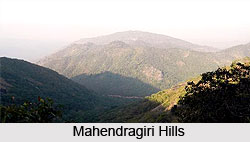
Mahendragiri Hill
Mahendragiri is a place of great scenic beauty. The place is surrounded on three sides by hills and thick growth of wild trees.
Tourism in West Garo Hills District
Tourism in West Garo Hills District comprises exploring several beautiful peaks as well as sites of historical importance. Wangala Dance festival of the Garo tribe is another major attraction for the travellers.
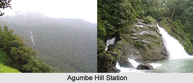
Agumbe Hill Station
Agumbe Hill Station in Karnataka is a well-known tourist spot for its sunsets, waterfalls research unit on king cobras.
Hilly and Forest areas
There are four hilly and forest areas in the Indian subcontinent, which are, still the safe haven of the Indian tribes.
Structure on a Hill
Vastu Shastra offers invaluable tips on the construction of a Structure on a Hill.
Yercaud Hill station
Yercaud is a fascinating hill station of Tamil Nadu, situated about 8 kms from Salem.
Wilson Hills
Wilson Hills offers a mesmerizing view of the vast Arabian Sea from a high altitude. The place is immensely enjoyed by the mountaineers and nature lovers.
East Garo Hills District
East Garo Hills District is one of the seven administrative districts of Meghalaya. Williamnagar is the district headquarters. East Garo Hills District is well known in north-east India for its handicrafts and textiles.
Garo Hills
Garo are part of the Garo-Khasi range in Meghalaya. People who reside in the Garo Hills are known as the Garos. The range is part of the Meghalaya subtropical forests eco-region.
Tourism in East Garo Hills District
Tourism in East Garo Hills District includes visits to several historical sites as well as those places that have some association with the culture of the local people. The natural beauty of the region adds charm to the tourism experience.
Khasi Hills
Khasi Hills belong to the Garo-Khasi range located in Himalayas. Khasi Hills are known for housing Sohra, popularly known as Cherrapunjee.
East Khasi Hills District
East Khasi Hills District, an administrative district of Meghalaya, was formed after the bifurcation of Khasi Hills District. Shillong is the district headquarters of East Khasi Hills District.
West Khasi Hills District
West Khasi Hills District is the largest district of Meghalaya with its administrative headquarters located at Nongstoin. West Khasi Hills District was formerly a part of Khasi Hills District and it came into existence in the year 1976.
South Garo Hills District
South Garo Hills District is an administrative district of Meghalaya with its headquarters located at Baghmara. South Garo Hills District is mainly inhabited by Garo Tribes.
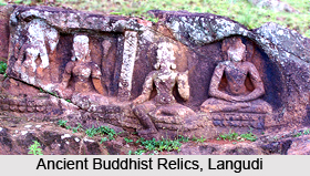
Langudi Hill
Langudi Hill, Odisha is a significant Buddhist archaeological site containing ruins of Pushpagiri University, rock-cut caves, Buddhist stupas and numerous other Buddhist relics.
Tendong Hill
Tendong Hill in South Sikkim is located at an altitude of 8530 ft. The hill is deeply revered by the local villagers.
Maenam Hill
Maenam Hill located near to Ravangla town in Sikkim is a famous tourist spot. One can enjoy the breathtaking view of the Kanchenjunga Peak and waterfalls.
Kolli Hills
Kolli Hills is a small mountain range located in Tamil Nadu. It is a part of the Eastern Ghats and serves as a great tourist spot.