 The state of Jharkhand is located in the eastern part of India. The geographical terrain of this state is characterized by Chota Nagpur Plateau, lush green hills, waterfalls and forests (covering 29.61% of the state). These, along with the state"s flora and fauna, fairs and festivals, temples, museums, rich mineral wealth and diverse culture draw a plethora of tourists here. Lakes of Jharkhand are no exception in this regard. They too have the potential to catch the attention of tourists visiting this state and add value to tourism here.
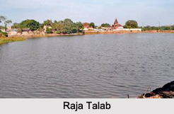
Raja Talab
Raja Talab is situated in Dhanbad. This large man made lake was built by Raja Jorawar Singh, the Raja of Jharia. This lake was later adorned and developed by Raja Shiva Prasad Singh. It occupies an area of about 8.46 acres. A small island in middle of the lake beautifies it. It came to light that the quality of this lake is being deteriorated by garbage, cattle, washing of clothes, immersion of Durga Puja idols and offerings made during Chhath Puja. Restoration of this lake is being carried out.
Dimna Lake
 Dimna Lake is situated at the foothills of Dalma Range. With the aim to provide water to the steel plant, Tata steel had established this lake. Lush green forests surrounding this lake and gardens rich with colorful flowers have offered a picturesque setting to this lake. This lake acts as tourism spot of Jharkhand, with its reservoir providing opportunity for water sports. More specifically, boating, jet skiing and rowing in particular seasons are the fun filled possibility on this lake.
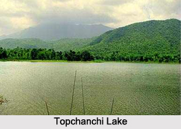
Topchanchi Lake
Topchanchi Lake is located about 37 km from Dhanbad. It is an artificial lake with green hills acting as its picturesque background. It was established in the year 1915 with the aim to bless Jharia with smooth and proper water supply. This lake with its surroundings is an ideal site for nature lovers and serves as a picnic spot.
Ranchi Lake
Ranchi Lake is located at the base of Ranchi Hill. This lake was built in the year 1842. A British agent namely, Colonel Onsley is credited with the establishment of this lake. The banks of the Ranchi Lake can be utilized as a picnic spot. This lake is also open to boating.


