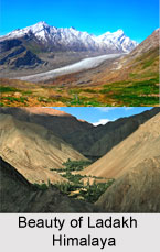
 Ladakh Himalaya is a range falling within the mighty Himalaya Mountains. Ladakh Himalayan range offers numerous exploration opportunities as it encompasses large rivers and their tributaries with carved deep valleys. Adventure enthusiasts from India as well as foreign land pay their visit to this beautiful travel destination.
Geography of Ladakh Himalaya
The Ladakh range, lying to the north of Leh, forms an important part of the Himalayan mountain chain. To its north lies the Khardung la, a motorable pass leading to the Eastern Karakoram (Nubra valley). This mountain range goes on to unite with the Kailash range in Tibet. Lying to the north east of Kashmir, the Ladakh Mountains also move on to form a part of the state of Jammu and Kashmir.
The range of the Ladakh Himalayas lies on the pointing northwest-southeast, the watershed between the Shyok and Indus River. There are a number of peaks found along this ridge, most of them up to 6200 metres. However, none of them have been scaled due to tight security in the region. To the east is the Pangong range which derives its name from the unique Pangong Lake. This lake is more than 200 km long and on an average five km wide. To the south of this lake is a group of mountains.
The Indus River enters the Ladakh Himalayan range near Demchok and goes on to pass through Leh. This is the famous Rupshu district. There were a few early travelers, who came from Spin which lies to its south. Two famous passes, the Parang la and the Takling la, lead into Rupshu from Spiti. To the south one finds several high peaks like Mata (6340 m), Monto (6230 m), Thalda Kurmi (6666 m), Zongchenmo (6470 m), along with a host of unnamed summits rising up to 6600 m. The southern periphery of Ladakh here is enclosed by the Spiti peaks dominated by Gya (6794 m) and Parilungbi (6166 m) in the Lingti valley.
Rupshu district stretches from the Tunglung la to the north, to Chumar in the south, Manecham Sump in the west and Hanle to the east, encompassing an area of about 15,000 sq km. It is an exceedingly dry district, even by Tibetan standards. All this expanse of high desert is nowhere below 4500 metres There are only three places where there are permanent dwellings. The Tso Moriri is an oval shaped lake found in Rupshu. To the west lies a huge ice-plateau almost 6000 metres in average height. This plateau drains into Rupshu on one side and into Zanskar on the other. This ice plateau is in the Panpo Lungpa region of West Rupshu and consists of huge snowfields, rising from 4800 metres to 6100 metres. The snow-line in the eastern and drier part of this district is at 6100 metres whereas on the western side it can be as low as 5200 metres.


