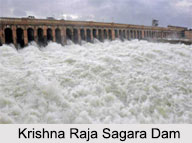
 Krishna Raja Sagara dam or KRS Dam, made in 1924, is below the confluence of river Kaveri with its tributaries Hemavati and Lakshmana Tirtha, in the district of Mandya in Karnataka. The water of the dam is used for irrigation in Mysore and Mandya, and it is the main source of drinking water for all of Mysore, Mandya and almost the whole of Bengaluru city, the capital of Karnataka. The water released from this dam flows into the state of Tamil Nadu and then it is stored in Mettur dam in the Salem district. The dam is 130 feet in height and has 152 sluice gates; the dam is spread over an area of 130 sq. km.
History of Krishna Raja Sagara Dam
Mysore and especially Mandya used to get extremely dry during summer season, as a result of which, in 1875-76, there has been a severe draught in those areas. The draught led to irrigation problems for the lack of water and most of the inhabitants of the area had to migrate to different locations to get rid of the draught. In such moment, Kaveri River was seen as a great potential source of water, which would also help for irrigation.
The Chief Engineer of Mysore M. Visvesvaraya presented a plan of the dam to construct it on the Kaveri River near Kannambadi village. At first, he was obstructed by government from executing his plan to build the dam. So, later he approached to T.Ananda Rao, the Diwan of Mysore and the Maharaja Krishna Raja Wadiyar IV to reconsider the project and help him to execute it; later government was also consented on this project. Finally, the construction began in the year 1911 on November; almost 10,000 workers were employed to execute the entire project. A mortar named surkhi was used instead of cement to build the dam. The construction of the dam got finally completed in 1931. The dam has walls with a length of 2621 meters and height of 39 meters.
Nearby Attraction of Krishna Raja Sagara Dam
Other than serving as a vast reservoir, the Krishna Raja Sagara Dam is also a well known tourist spot. The famous Brindavan Garden is located on the patio of the dam. The garden is gracefully decorated with lights and has many colorful fountains. Tourists while visiting this spot, often like to come to this garden.
Visiting Information to KRS Dam
The best time to visit the dam is from June to August as the water level increases this time due to heavy rainfall. KRS Dam is well connected to Bangalore and Mysore by roads and railways.


