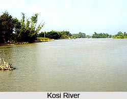
 Kosi River, one of the main rivers in Bihar and a prominent tributary of the Ganges, originates in the Himalayas. Along with its tributaries the Kosi River traverses along parts of Tibet including the Mount Everest region and also one third of the eastern part of Nepal. The river has shifted its course from east to west about 120 kilometers in the last two hundred years.
The Kosi"s alluvial fan located in the northern part of India is one of the largest alluvial cones built by any river in the world. The fan has fertile soil and abundant groundwater in a part of the world where agricultural land is in great demand. Subsistence farmers balance the threat of starvation with that of floods. As a result, the flood-prone area is densely populated and subject to heavy loss of life. India has more flood deaths than any country except Bangladesh.
Cultural significance
The Kosi River was previously known as Kausiki and it is on the banks of this river that sage Visvamitra became a Vedic rishi. In the Indian epic Mahabharata this river is mentioned as Kausiki. Seven koshis merge together to form the Saptakoshi River, which is popularly known as Koshi.
The Koshi is associated with many ancient spiritual stories. Kosi is mentioned in the Bal Kand section of Valmiki Ramayana as the Kausiki who is the form assumed by Satyavati after her death. Satyavati was the elder sister of Viswamitra, descendants of Kushak dynasty. In the Markendeya Purana, the Kosi is described as the primal force. Due to the violent nature of the Kosi during monsoon season, legend says that Parvati, the wife of Shiva, after defeating the demon Durg, became known as the warrior goddess Durga who transformed into Kaushiki. In Ramayana, the river Ganges is depicted as her elder sister.
According to Mahabharata epic, the God of death took the form of a woman and resides on the banks of the river to limit population growth. Kosi resonates with the folklore of Mithila. The most important depictions of Kosi folklore are Kosi as a virgin absolutely carefree and full of energy and as a frustrated wife of old hermit Richeek wandering in the Himalayas. Kosi is also invoked as the mother - `Kosi Ma`.
In Nepal, Koshi River lies in the west of Kanchenjunga. It has seven major tributaries Sun Koshi, Tama Koshi or Tamba Koshi, Dudh Koshi, Indravati, Likhu, Arun and Tamore or Tamar.
Sorrow of Bihar
Kosi is known as the "sorrow of Bihar", as it has caused widespread human suffering in the past due to flooding and very frequent changes in course, when it flows from Nepal to Bihar.
On 18 August 2008, the Kosi River picked up an old channel it had abandoned over 100 years previously near the border with Nepal and India. Approximately 2.7 million people were affected as the river broke its embankment at Kusaha in Nepal, submerging several districts of Nepal and India. 95% of the Kosi`s total flowed through the new course. The worst affected districts included Supaul, Araria, Saharsa, Madhepura, Purnia, Katihar, parts of Khagaria and northern parts of Bhagalpur, as well as adjoining regions of Nepal. 150 people were reported washed away in a single incident.
The river is also the lifeline of the Mithila region, today spread over more than half of Bihar, and parts of adjoining Nepal and forms the basis of legend and folklore of the region.
Development Projects
The Kosi project was thus conceptualized, in three continuous interlinked stages - the first was a barrage to anchor the river that had migrated about 120km (75m) westward in the last 250 years laying waste to a huge tract in north Bihar and to provide irrigation and power benefits to Nepal and India. The second part was to build embankments both below and above the barrage to hold the river within the defined channel. The third part envisaged a high multipurpose dam within Nepal at Barakshetra to provide a substantial flood cushion along with large irrigation and power benefits to both countries.


