Home > Indian History > Geography of India > Kolkata Metro
Kolkata Metro
Kolkata Metro is an urban railway system in Kolkata connecting the South 24 Parganas and North 24 Parganas with Kolkata.

Share this Article:

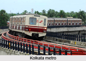
Kolkata Metro, Indian RailwaysKolkata Metro is an urban metro railway transport system in Kolkata, West Bengal. It connects the districts of South 24 Parganas District and North 24 Parganas District in West Bengal.

Connecting Lines of Kolkata Metro
The network of Kolkata Metro is currently consisting of one operational line from Noapara to Kavi Subhash. Five other lines are under construction. Kolkata Metro was the first metro railway in India, opening for commercial services from 1984.

History of Kolkata Metro
It was in the year 1947 the transport problem of Kolkata drew the attention of city planners, the state government and also the government of India. Dr. Bidhan Chandra Roy, the then Chief Minister of West Bengal has the idea of building an Underground Railway for Kolkata to try to solve the problems. A survey was done by a team of French experts, but nothing concrete came out of this. The efforts to solve the problem by augmenting the existing fleet of public transport vehicles hardly helped, since roads account for only 4.2% of the surface area in Kolkata, compared with 25% in Delhi and even 30% in other cities. With a view to finding alternative solutions to alleviate the suffering of the people of Kolkata, the Metropolitan Transport Project (Rlys) was set up in 1969. The Railway Ministry with help of Soviet specialists Lenmetroproekt and East German engineers, prepared a master plan to provide five rapid-transit lines for the city of Kolkata, totalling a route length of 97.5 km in 1971 and led the establishment of Metro Railways in Kolkata.
Kolkata Metro, Indian RailwaysExtension of Metro Railways
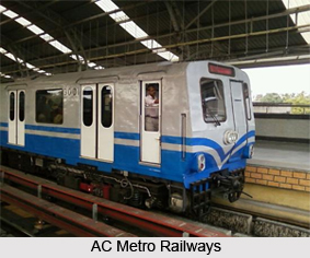
On 29th December 2010, Kolkata became the 17th zone of the Indian Railways, operated by the Ministry of Railways. Previously there was only one metro railway in Kolkata. But currently there is another metro railway growing in Kolkata called East West Metro Corridor operated by Kolkata Metro Rail Corporation which is a Government of India Enterprise.

Security of Kolkata Metro
All the stations of Kolkata Metro are equipped with closed-circuit cameras, metal detectors, and X-ray baggage scanners, making the metro the safest form of transport in Kolkata. The taking of photographs, eating, drinking and smoking are all prohibited on the metro premises.

Related Articles
Metropolitan Cities in India
Delhi Metro
Metro Railways in India
Kolkata
West Bengal
Indian Railways
Indian Railway Zones
History of Indian Railways


Share this Article:

Related Articles

More Articles in Geography of India


Geography of Uttar Pradesh
The fourth largest State in India UP is located in the Northern part of India whose area is 2,36,286 sq Kms.
Geography of Maharashtra
Covering an area of 308,000 sq. km, Maharashtra, the third largest state in India.
Geography of Kerala
Geography of Kerala includes plains, hills, valleys and coasts. With the Arabian Sea in the west, the Western Ghats in the east and networked by several rivers, Kerala enjoys diverse geographical features.
Geography of West Bengal
The geography of West Bengal is unique with high peaks of the Himalayan range in the north, the Bay of Bengal in the south and the remaining region is covered with both plains and plateaus.
Geography of Jharkhand
Geography of Jharkhand is comprised of the rich mineral resources and the highly agricultural prospect in this state.
Geography of Sikkim
Geography of Sikkim is characterised by a vast array of magnificent hillock that extends from one corner of the state to the other.
Geography of Meghalaya
The suitable climate, highland plateaus, rivers and the flora and fauna together forms the geography of Meghalaya.
Geography of Mizoram
Mizoram is surrounded by hills, valleys, rivers, waterfalls and lakes. The hills range from 1000 meters to 2000 meters. Rivers, lakes and waterfalls also play major role in forming the land of Mizoram.
Geography of Jammu & Kashmir
Jammu and Kashmir is encompassed by valleys. Some of the dominant valleys of the state are Kashmir Valley, Tawi Valley, Chenab Valley, Poonch Valley, Sind Valley and Lidder Valley etc. Jhelum River is the only major Himalayan River which flows through the Kashmir valley. Indus, Tawi, Ravi and Chenab Rivers are the major ones flowing through the region.
Geography of Daman and Diu
Daman and Diu is situated on the west coast of India and are the smallest union territories of India.
Geography of Goa
Geography of Goa occupies a prime location along the Konkan coastal belt on the western coast of India. The state is bordered by Maharashtra in the north and Karnataka in the south. The Western Ghats in the east contribute to the flora and fauna of Goa.
Geography of Arunachal Pradesh
Geography of Arunachal Pradesh reveals that it is a hilly tract nestled in the foot of Himalayas.
Geography of Kutch
Geography of Kutch District is covering an area of 45,612 km. Kutch District is the largest district in the state of Gujarat.
Geography of Ladakh
Geography of Ladakh mainly comprises the huge Karakoram Range with long stretch of cold desert which mark the region separately from the rest of the states of Indian subcontinent. Surrounded with the mountain ranges from all corners this small region separates Indian subcontinent from rest of the Asian continent.
Geography of Rajasthan
Geography of Rajasthan defines the dry topography with arid climate of the western mountain region.
Geography of Tamil Nadu
The Indian state of Tamil Nadu is located in the Northern hemisphere in the hot zone.