Home > Indian History > Geography of India > Kolkata Circular Railway
Kolkata Circular Railway
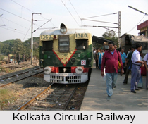
Kolkata Circular Railway which is also known as Chakra Rail operated by the Eastern Railways encircling the entire city of Kolkata.

Share this Article:

Kolkata Circular Railway, Kolkata, West BengalKolkata Circular Railway also known as the "Chakra Rail" locally, is a railway loop line operated by the Eastern Railway zone of Indian Railways, encircling the entire city of Kolkata.

Expansion of Kolkata Circular Railway
The line of Kolkata Circular Railway begins and terminates at Biman Bandar station, with a total of 21 stations spread over the route`s 35 kilometres length. The services on the line are operated as an extension of the Kolkata Suburban Railway, partially sharing tracks with the Sealdah South lines, terminating at Sealdah railway station.

Stations in Kolkata Circular Railway
Kolkata Circular Railway services are operated from Biman Bandar to Majerhat (via Burrabazar), and Majerhat to Biman Bandar (via Ballygunge), sharing the stations Dum Dum Junction and Dum Dum Cantonment both ways. The line operates a part of longer suburban services from Budge Budge, Canning, Barrackpur, and Hasnabad.

Kolkata Circular Railway and Kolkata Metro
Kolkata Circular Railway offers no direct interchange points with the Kolkata Metro as of 2015, though that will change once Line 3 is constructed via Majerhat.

Loop Line of Kolkata Circular Railway
The loop line serves Kolkata railway station, one of the major intercity stations in Kolkata, as well as a number of prominent city landmarks including Prinsep Ghat and Eden Gardens. In addition, a 3.7 km-long line connecting Dum Dum Cantonment to the Netaji Subhash Chandra Bose International Airport became the first such suburban railway line in India to serve an airport, and allowed extended Circular Railway operations from Dum Dum Junction and beyond. However, the poorly-patronized branch line is likely to be replaced by Line 4 of the Metro, which follows roughly the same route.

Extension of Kolkata Circular Railway
Kolkata Circular Railway has been extended from Dum Dum Cantonment to Netaji Subhash Chandra Bose International Airport. It is a 3.8 km extension from Dum Dum Cantonment station and includes two elevated stations Jessore Road and Biman Bandar. It runs at grade to U.K Dutta Road and then on an elevated structure to the airport passing through Jessop, Jessore Road, VIP Road, and the domestic terminal road. This project was undertaken by the Kolkata Metro. The Jessore Road station has been closed since January 7, 2015.


Share this Article:

Related Articles

More Articles in Geography of India


Geography of Uttar Pradesh
The fourth largest State in India UP is located in the Northern part of India whose area is 2,36,286 sq Kms.
Geography of Maharashtra
Covering an area of 308,000 sq. km, Maharashtra, the third largest state in India.
Geography of Kerala
Geography of Kerala includes plains, hills, valleys and coasts. With the Arabian Sea in the west, the Western Ghats in the east and networked by several rivers, Kerala enjoys diverse geographical features.
Geography of West Bengal
The geography of West Bengal is unique with high peaks of the Himalayan range in the north, the Bay of Bengal in the south and the remaining region is covered with both plains and plateaus.
Geography of Jharkhand
Geography of Jharkhand is comprised of the rich mineral resources and the highly agricultural prospect in this state.
Geography of Sikkim
Geography of Sikkim is characterised by a vast array of magnificent hillock that extends from one corner of the state to the other.
Geography of Meghalaya
The suitable climate, highland plateaus, rivers and the flora and fauna together forms the geography of Meghalaya.
Geography of Mizoram
Mizoram is surrounded by hills, valleys, rivers, waterfalls and lakes. The hills range from 1000 meters to 2000 meters. Rivers, lakes and waterfalls also play major role in forming the land of Mizoram.
Geography of Jammu & Kashmir
Jammu and Kashmir is encompassed by valleys. Some of the dominant valleys of the state are Kashmir Valley, Tawi Valley, Chenab Valley, Poonch Valley, Sind Valley and Lidder Valley etc. Jhelum River is the only major Himalayan River which flows through the Kashmir valley. Indus, Tawi, Ravi and Chenab Rivers are the major ones flowing through the region.
Geography of Daman and Diu
Daman and Diu is situated on the west coast of India and are the smallest union territories of India.
Geography of Goa
Geography of Goa occupies a prime location along the Konkan coastal belt on the western coast of India. The state is bordered by Maharashtra in the north and Karnataka in the south. The Western Ghats in the east contribute to the flora and fauna of Goa.
Geography of Arunachal Pradesh
Geography of Arunachal Pradesh reveals that it is a hilly tract nestled in the foot of Himalayas.
Geography of Kutch
Geography of Kutch District is covering an area of 45,612 km. Kutch District is the largest district in the state of Gujarat.
Geography of Ladakh
Geography of Ladakh mainly comprises the huge Karakoram Range with long stretch of cold desert which mark the region separately from the rest of the states of Indian subcontinent. Surrounded with the mountain ranges from all corners this small region separates Indian subcontinent from rest of the Asian continent.
Geography of Rajasthan
Geography of Rajasthan defines the dry topography with arid climate of the western mountain region.
Geography of Tamil Nadu
The Indian state of Tamil Nadu is located in the Northern hemisphere in the hot zone.