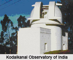
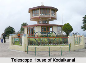
 Kodaikanal Solar Observatory is a solar observatory situated in Tamil Nadu state of India. Owned and operated by Indian Institute of Astrophysics, it is located on the southern tip of the Palni Hills 4 km from Kodaikanal town in Dindigul district of Tamil Nadu. This serves as a platform to make Ionospheric soundings, geomagnetic, F region vertical drift and surface observations. The observatory is run by a full-time staff of two scientists and nineteen technicians.
History of Kodaikanal Solar Observatory
The Observatory was founded on April 1, 1899 with the aim of studying the sun to better understand monsoon patterns and to obtain accurate measures of the sun"s heating power at the earth"s surface and its periodic variations. The first observations were made in 1901. Ionosonde and geomagnetic facilities were installed in 1955. A 12 m solar tower with modern spectrograph was established in 1960 by Amil Kumar Das. The spectrograph used to perform helioseismology investigations. Measurements of vector magnetic fields were initiated during the 1960s. T. Royds, A. L. Narayan and Amil Kumar Das were the directors of Kodaikanal Solar Observatory between 1922 and 1960. In 1960 M. K. Vainu Bappu took the role of director of the observatory.
 Research Areas of Kodaikanal Solar Observatory
Some of the research areas of Kodaikanal Solar Observatory are as follows-
•It observes and interprets the morphological changes in active regions and their role in occurrence of transients such as solar flares.
•It measures the vector magnetic fields.
•It studies the structure and dynamics of equatorial ionosphere and its response to the solar and interplanetary variability.
•It studies the equatorial electro-jet and the structure and dynamics of equatorial ionosphere.
•It makes hourly observation of surface temperature, pressure and rainfall. The information collected is transmitted to the India Meteorological Department and the World Meteorological Organization for use in Weather forecasting and research in the atmospheric sciences.
Equipments of Kodaikanal Solar Observatory
It has a good number of equipments to carry out its research activities. It has equipments like 20 cm Aperture English Mounted Heliostatic Refractor, Solar Tunnel Telescope, Ionosonde, High Frequency Doppler Radar, Lacour Magnetometer, Watson Magnetometer, Broadband Seismograph, GPS Receiver and Magnetic Variometers.
The 20 cm refractor is utilized for cometary and occultation observations. Sometimes it is also made available to visitors for night sky viewing. The telescope is used for activities like recording the spectrum photographically, enhancing the coverage of spectrum especially for the broad resonance lines and the nearby continuum etc. Ionosonde is used for studying the ionospheric and geomagnetic effects of solar activity.


