 Kaziranga National Park is located in Assam, a north eastern state of India. More specifically, this national park is situated in the Kaliabor subdivision of Nagaon district and the Bokakhat subdivision of Golaghat district, on the edge of the Eastern Himalaya biodiversity hotspot. This national park has been designated as a UNESCO (United Nations Educational, Scientific and Cultural Organization) World Heritage Site. Kaziranga has also been designated as an important Bird Area by BirdLife International, for the conservation of avifaunal species. Highly diverse and visible species has resulted in the park being labeled as a biodiversity hotspot. In the year 2005, this national park had celebrated its centennial.
History of Kaziranga National Park
Mary Curzon, wife of the Viceroy of India, Lord Curzon of Kedleston, had visited the park area in the year 1904. This area was popular for supporting the population of rhinoceros. On a contrary to what the park area was famous for, Mary Curzon was unable to see a single rhinoceros. She then asked Lord Curzon to take necessary steps to conserve rhinoceros in the area. As a result of her observation, the Kaziranga Proposed Reserve Forest was created on 1 June, 1905. It occupied an area of about 232 square kilometers (90 sq mi). In the year 1908, Kaziranga was designated a Reserve Forest. In the year 1916, Kaziranga was re-designated as the Kaziranga Game Sanctuary. In the year 1950, Kaziranga Game Sanctuary was renamed as Kaziranga Wildlife Sanctuary to remove hunting connotations from the name of the park. This renaming was done by P. D. Stracey, who was a forest conservationist.
In the year 1954, the Assam (Rhinoceros) Bill was passed by the government of Assam, according to which heavy penalties would be imposed on people for the poaching of rhinoceros. In 1968, Kaziranga was declared as a national park, according to the Assam National Park Act of 1968. The 430 square kilometers (166 sq mi) park was given official status by the central government on 11th February, 1974.
Geography of Kaziranga National Park
Globally, Kaziranga National Park can be pinpointed at coordinates 26 degrees 30 minutes north to 26 degrees 45 minutes north latitudes and 93 degrees 08 minutes east to 93 degrees 36 east longitudes. From east to west, Kaziranga has an approximate length of about 40 km (25 mi). From north to south, this park has a breadth of about 13 km (8 mi). This park is spread over an area of about 378 square kilometers (146 sq mi), out of which approximately 51.14 square kilometers (20 sq mi) has been lost to erosion in recent years. This park is one of the largest tracts of protected land in the sub-Himalayan belt. The park area has been divided into five ranges. They are Burapahar, the western range, the central range, the eastern range and the northern range. The elevation of this park ranges from about 40 m (131 ft) to about 80 m (262 ft). The northern and eastern boundaries of this park are formed by the Brahmaputra River, whereas its southern boundary has been formed by the River Mora Diphlu. Another river located within the park is Mora Dhansiri. Erosion and silt deposition by the River Brahmaputra has resulted in flat expanses of fertile, alluvial soil in the park.
Climate of Kaziranga National Park
Kaziranga National Park experiences summer, monsoon and winter seasons. Kaziranga receives an annual rainfall of about 2,220 mm (87 in). The summer season is hot here and the winter season is experienced as mild and dry. July and August are the months when the water level in the River Brahmaputra rises, causing floods and submerging three-fourths of the western region of the park.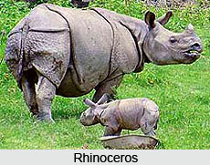
Flora of Kaziranga National Park
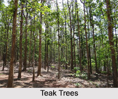
Kaziranga National Park has four main types of vegetative covers. These are alluvial inundated grasslands, alluvial savanna woodlands, tropical moist mixed deciduous forests and tropical semi-evergreen forests.
Fauna of Kaziranga National Park
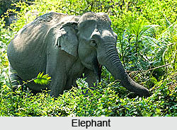
Kaziranga National Park serves as a home to significant breeding populations of about 35 mammalian species, of which 15 are threatened according to the IUCN (International Union for Conservation of Nature and Natural Resources) Red List. This park provides shelter to the world`s largest population of the greater one-horned rhinoceros, wild Asiatic water buffalo and eastern swamp deer. Some of the other animals preserved in the park are elephants, gaurs, sambars, Indian muntjacs, Indian tigers, leopards, Chinese pangolins, Indian pangolins, hog badgers, Chinese ferret badgers, wild boars and hog deer.
Avifauna of Kaziranga National Park
Kaziranga National Park also supports various species of birds. Some of them are lesser adjutant, vulture, greater adjutant, Blyth`s kingfisher, white-bellied heron, Dalmatian pelican, spot-billed pelican and black-necked stork.
Management of Kaziranga National Park
Kaziranga National Park is managed by the wildlife wing of the forest department of the Government of Assam, which is headquartered in Bokak. The administrative head of the park is called director, who is a chief conservator of forests-level officer. The park receives financial aid from the State Government as well as the Ministry of Environment, Forests and Climate Change of Government of India, under various plan and non-plan budgets. Under Project Elephant, the Central Government provides more fund to the park. National and international non-governmental organizations also contribute in raising the park"s fund.
Threats to Kaziranga National Park
Kaziranga National Park has experienced several natural and man-made calamities in recent decades. Due to overflowing of River Brahmaputra most animals migrate to elevated and forested regions, outside the southern border of the park, such as the Mikir hills. This results in considerable reduction of animal life in the park. Encroachment by people along the periphery has brought about decrement in the forest cover and has also resulted in the loss of habitat. In the year 2012, about 540 animals, including 13 rhinos and mostly hog deer were reported as perished in the floods. The park also experiences food shortages and occasional forest fires, which are caused by occasional dry spells.
Conservation of Kaziranga National Park
Steps have been taken to develop Kaziranga into a safe shelter for numerous species. Various laws like the Assam Forest Regulation of 1891 and the Biodiversity Conservation Act of 2002 have been enacted for protection of wildlife in the park. As a part of the conservation plan, there has been construction of anti-poaching camps, maintenance of existing camps, patrolling, intelligence gathering and usage of cameras on drones, which are monitored by security guards. To prevent animal losses from flooding, the authorities have purchased additional speedboats for patrolling and have created artificial highlands for shelter.
Visiting Information
Kaziranga National Park is well connected to different major cities of India by airways, railways and roadways. The nearest airport to this national park is in the town of Jorhat. This airport is located at a distance of about 97 kilometers from the park. Another airport in Guwahati is located at a distance of about 217 kilometers from Kaziranga that serves as a viable option for the tourists to reach Kaziranga. The nearest railway station to Kaziranga is in Furkating. This railway station is located at a distance of about 80 kilometers from the park. Roads leading to Kaziranga National Park are motorable by buses. One would firstly have to reach Guwahati or Jorhat by rail or air to avail the bus to Kaziranga.
Related Articles
Indian National Parks
Indian Wildlife Sanctuaries
Bird Sanctuaries in India
Indian Wildlife
Conservation of Indian Wildlife
