Introduction
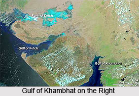
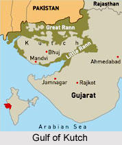
Kathiawar, also called Saurashtra Peninsula is bounded by the Little Rann (marsh) of Kachchh (Kutch) to the north, the Gulf of Khambhat to the east, the Arabian Sea to the southwest, and the Gulf of Kutch to the northwest. From the northeast an ancient sandstone formation extends into the peninsula, which has an area of 23,000 square miles (60,000 square km). Most of the sandstone, however, is masked by lavas. The coastal regions are flanked west and east by clays and limestones and south by alluvium and miliolite, a wind-deposited sand concretion known as Porbandar stone and widely used for building material. Bhavnagar is the principal port and city in Kathiawar.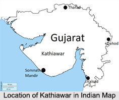
History of Kathiawar
Kathiawar got its name from the Kathi community which is spread all over the region. In spite of settling down in the region during the 16th century, they have exercised an influential role in the documented history of the region. Major Rajput clans that have significantly influenced this region include the Walas (Kathis), Jethwas, Raijadas, Chudasamas, Gohils, Parmars, Jhalas, Jadejas, Chavdas, Solankis, Patgirs or Pargirs, and Sarvaiyas, Savjis. Most of the princely states of Kathiawar were brought under the British protectorate by 1820. The first treaty with the British from Kathiawar was carried out by Vira Wala of Jetpur with Col. Walker at Baroda on 26th October 1803.
Political History of Kathiawar
Major part of Kathiawar was divided into many princely states before the Indian Independence in 1947. These small provinces were ruled by the local rulers who subjugated themselves to the British authority in return for local sovereignty. These states comprised the Kathiawar Agency. In the east the rest of the peninsula along the Gulf of Cambay or Gulf of Khambhat, were districts ruled directly by the British as part of British India`s Bombay Presidency, which included the part of the peninsula.
After Indian independence, the states of Kathiawar acceded to India. In 1947, Junagadh`s Muslim ruler desired accessing his territory to Pakistan, but the Hindu population rebelled. The prince however fled to Pakistan and in his absence a plebiscite was conducted, as a result of which the kingdom was merged into the Indian Union. Pakistan still retains a claim to it. The former princely states of Kathiawar were grouped into the new province of Saurashtra, which became a state in 1950. In 1956, Saurashtra was merged into Bombay State, and in 1960, Bombay state was divided along linguistic lines into the new states of Gujarat and Maharashtra. Diu remained under the Portuguese till 1961 when it was occupied by Indian troops. It later became part of India as the union territory of Goa, Daman and Diu in 1962.
Flora of Kathiawar
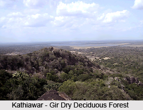
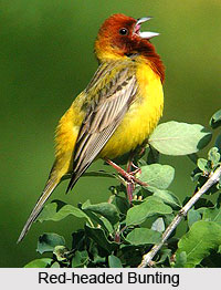
Kathaiwar is surrounded mostly by xeric scrub. A range of low hills, known as the Gir Hills, occupies the south-central portion of the peninsula. The highest of these is Girnar. The Kathiawar-Gir dry deciduous forests in India are a tropical dry broadleaf forest eco-region. The composition of the Kathiawar-Gir dry deciduous forests in India varies with moisture and soils. The wetter areas contain three-storied forests that are dominated by Teak in association with Agele marmelos, Boswellia serrata, Ougeinia oojeinensis, Diospyros spp., Bombax ceiba, Sterculia urens, Emblica officinalis, Dalbergia paniculata, and Terminalia tomentosa, etc.
National Parks in Kathiawar
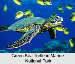
Gir National Park, which includes the forested hills around Girnar, is home to the last remaining Asiatic lions left in the wild. Other national parks on Kathiawar are Blackbuck (Velavadar) National Park on the Gulf of Cambay and Marine National Park, on the Gulf of Kutch near Jamnagar.
Occupation in Kathiawar
Agriculture is the chief occupation on this peninsula. The principal crops raised include wheat, millets, peanuts (groundnuts) and cotton. People of Kathiawar also cultivates dates and sugarcane. Apart from agriculture, the region is a rich producer of milk and milk products. Due to its proximity to the coastal area, the region is also known for overseas trading. Bhavnagar is the principal port of Kathiawar.
Tourism in Kathiawar
Kathiawar, a prominent peninsula in Gujarat, India, is a region rich in historical, religious, and natural attractions. It draws tourists from across the country and beyond, offering a blend of heritage, spirituality, and wildlife experiences.
Dwarka, one of the Char Dham pilgrimage sites, is a major destination in Kathiawar. It is home to the Dwarkadhish Temple, dedicated to Lord Krishna. Another significant religious site is Somnath, known for the Somnath Temple, which holds immense spiritual importance as the first of the twelve Jyotirlingas.
For wildlife enthusiasts, Sasan Gir is a key attraction, being the only habitat of the Asiatic lion. The Gir National Park provides an opportunity to witness diverse flora and fauna in their natural surroundings. Junagadh, a city with historical significance, features sites like Uparkot Fort, Mahabat Maqbara, and Girnar Hill, which is a major pilgrimage site for Hindus and Jains.
Palitana's Shatrunjay Hills are renowned for their Jain temples, attracting devotees and visitors interested in ancient architecture. Vallabhi, an ancient center of learning, holds historical value. Virpur (Rajkot), known for Jalaram Bapa Temple, is another site of religious significance.