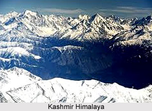
 Great Himalayan axis runs southeast from Nanga Parbat to Nun-Kun forming the northern boundary of Kashmir Himalaya. Beyond this to the northeast lies Ladakh, to the east lies Zanskar and towards the southeast Kishtwar. They all form part of Kashmir as a state, but for mountaineers, they are different geographical entities. The Sind River meets the Liddar in the broad vale of Kashmir and they both cut a gorge through the Pir Panjal range near Baramula, the Pir Panjal range itself forming the southern boundary of the valley.
There are some famous and important passes on both sides of Kashmir. On the Pir Panjal range the best known is the Pir Panjal pass (3490 m) which gives its name to the whole mountain range. It was the most frequented pass between the states of Punjab and Kashmir. The other pass, Banihal (2740 m), has been the common route into Kashmir. The Jhelum Cart-Road was constructed during the 1880s and a motor road was made through the pass in the year 1910. Later, in 1960s, a long tunnel through Banihal was engineered, which now allows vehicular traffic to ply throughout the year. To the north, the lowest mark in the range is the Zoji la (3530 m) which was the main caravan route to Leh District and distant Central Asia.
Once, Kashmir was considered as the starting point for all the caravans, shikaris and climbers venturing into the Karakoram. In the year 1947 it became the bone of contention between India and Pakistan and has since then witnessed hostilities in 1962, 1965 and in 1971. So today, in order to reach the base of Nanga Parbat (as for all the other peaks in the Western Karakoram) one has to pass through Pakistan. In the valley of Kashmir, no summit rises above 6000 m but there are innumerable peaks between 4800 metres and 5800 metres. Most of them are easily accessible from Srinagar. The three major peaks of Kashmir Himalayan region are Kolahoi (5425 m), Haramukh (5143 m) and Koh-i-Nur (5137 m).
 Dr Arthur and Dr Ernest Neve came to Kashmir in 1882 and they visited almost every valley in Kashmir. They climbed most of the higher summits of the Pir Panjal lying in Kashmir, as well as all the five summits of the Haramukh massif. The surveyors, as in all the other ranges, were there well before the climbers. Capt T. G. Montgomerie was the chief organizer for the Survey of Kashmir. G. Shelverton took the first observations, and K2 was thus discovered and measured. One of the major climbing areas of the Kashmir Himalayas is that of the Thajiwas glacier and its environs. There are innumerable peaks within easy reach of Sonamarg and Pahlgam.
The three major peaks of the Kashmir valley are as follows -
Kolahoi (5425 m)
These groups of peaks were the main target for climbers in the earlier days. It is locally known as `Gashibrar` (the Goddess of Light). Its first recorded attempt was in the year 1911 by Captain Corry and Lt Squires. The same year Dr E. Neve and K. Mason made the first ascent of a lower peak to the south known as Bur Dalau (5110 m). The next ascent was by C. R. Cooke and Lt B. W. Battye in the year 1926. They climbed the East Ridge via the Neve-Mason Couloir. Returning from their trip to the Karakoram in 1935, John Hunt and Rowland Brotherhood followed a different route to the summit. And since then the mountain has become one of the favourite destinations for many mountaineers and it has received several ascents later on. Moreover, there are quite a number of smaller summits in the group which could offer a variety of technical challenges to those with a head for lesser heights.
Koh-i-Nur group
There are mainly three peaks in this group. In the year 1898, C. G. Bruce climbed the northeastern summit at the same time as the first ascent of the southeast and highest peak (5137 m) was made. The middle summit, Kunyirhayan (5098 m), was climbed in 1911 by Captain J. B. Corry, Lt R. D. Squires and K. Mason.
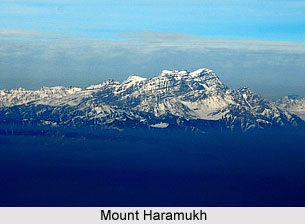
Haramukh (5143 m)
This group comprises a group of total five peaks. The first recorded ascent of the main summit was by Dr E. Neve and G. W. Millais in the year 1899. This was followed by C. G. Bruce and A. L. Mumm in 1907 and since then it has been regularly climbed, along with the other summits in the group.
It is simply difficult to describe the beauty of Kashmir Himalaya in plain words. Travelers, especially those returning from the drier parts of Ladakh and Zanskar, have been charmed by the contrast of the lush green vale.


