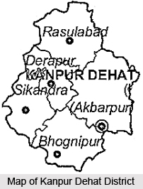
 Kanpur Dehat District, an administrative district of Uttar Pradesh, has its headquarters located at Akbarpur. This district is surrounded by districts Kanpur Nagar, Hamirpur, Jalaun, Etawah, and Kannauj. Yamuna River divides Kanpur Dehat District and Jalaun District. Kanpur Dehat District is located at 26 degree to 25 degree 55 minutes north latitude and 79 degree 30 minutes east to 80 degree east longitude. Total area of Kanpur Dehat District is around 3021 sq kms. Average altitude of this district is 471 feet above the sea level. Rural population outweighs urban population in Kanpur Dehat District.
History of Kanpur Dehat District
Kanpur is a transformed version of its original name Kanhapur given by the two rulers Hindu Singh of Sachendi and Ghanshyam Singh of Ramaipur. British ruler Hobson Johnson found the word difficult to pronounce and he changed it to Cawnpore. Later it came close to its name as Kanpur. Kanpur was divided into two districts namely Kanpur Nagar and Kanpur Dehat in the year 1977. However, it was reunited again in the year 1979 and again was separated in 1981.
Administration of Kanpur Dehat District
Administration of Kanpur Dehat District includes five Tehsils namely Akbarpur, Derapur, Rasoolabad, Bhognipur and Sikandara and 10 Development Blocks. There are 102 Nyay Panchayats and 613 Gram Sabhas in this district. The 10 development blocks of this district are Akbarpur, Maitha, Sarvankhera, Derapur, Jhinjhak, Rasulabad, Amraudha, Malasa, Sandalpur and Rajpur.
 The responsibility of administration of Kanpur Dehat District rests mainly with the District Magistrate and the Chief Development Officer. Two Additional District Magistrates and one District development Officer, one Sub Divisional Magistrate at each Tehsil and one Block Development Officer at each Block assist the district administration. Superintendent of Police at district level and a Deputy Superintendent of Police at Tehsil level also assist the District Magistrate in the maintenance of law and order in the district.
Economy of Kanpur Dehat District
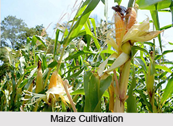
Kanpur Dehat District, situated in the middle of Ganga River and Yamuna River, is agriculturally dominating district. Thus, the economy of this district is mainly agrarian in character. Near about 83 percent rural population by and large depends on agriculture. Although agro-climatic conditions of the district are congenial for growing of crops throughout the year but certain pre-requisite facilities are lacking for optimum growth of the crops. Main reasons for low cultivation in some of the blocks in the district are uneven lands and lack of irrigation resources. Wheat, paddy, rice, pulses, sugarcane, oilseeds, maize and potato are the main cultivated crops of the district. The irrigation facilities in the district are not adequate. Fisheries and animal husbandry also constitute to the economy of Kanpur Dehat District to some extent. Agriculture and animal husbandry are the main occupations in Kanpur Dehat District.
Jagdishpur Mela, Dussehra, Ramlila, Maghi Mela, Cattle-fair, Kartika Purnima, Vasant Panchami, Janmashtami, Shivaratri, Ashtami fair, etc. are some of the main fairs and festivals of the district. Kanpur Dehat District is a quite backward district of the state.


