Home > Indian History > Geography of India > Kalpeni Island
Kalpeni Island
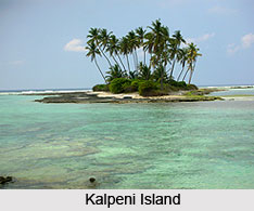
Kalpeni Island is an ideal tourist destination of Lakshadweep Islands. Kalpeni Island attracts a large number of tourists of both national and international level for its pristine beaches.

Share this Article:

Kalpeni IslandKalpeni Island is an inhabited island, located in the Union Territory of Lakshadweep Island. It has a population census of 4418 according to 2011 Census.

Kalpeni Island is located at about 218 kilometres west from the port of Kochi and lies 71 kilometres south of Androth and 201 kilometres to the NNE of Minicoy, with the broad Nine Degree Channel between them. The uninhabited Suheli Par atoll lies 139 kilometres to the east of Kalpeni Island Beach.

Kalpeni Island forms a single coral atoll along with the uninhabited islands of Cheriyam, Tilakkam and Pitti islet, which are not the dwelling places. The eastern and southern shorelines of the Kalpeni Island have accumulations of coral debris, the result of a violent storm that hit the area in 1847. Kalpeni Island was the first island in the Union Territory where women were allowed to go to school and get an education.

Kalpeni Island has a beach at the northern tip which is called Tip Beach. There one can do the snorkelling, sea bath and kayaking. Because of the coral reefs present in the sea near the beach, the water is shallow and calm, making it an excellent spot for beach activities.

There is a 37 meter high lighthouse in Kalpeni Island from whose top one can see a bird`s eye view of the island, the lagoon with the smaller islands, the reef and the surrounding ocean.

From the top of the lighthouse, one can visualize the abundance of coconut trees and the ground is not visible due to dense packing of the tops of these trees. Juma Masjid is one of the architectural monuments situated in this island. The best season to visit Kalpeni Island is winter season. It can be well accessible in onset of summers. The favourable months to visit Kalpeni Island and its beach are between in November to March. The climate of Kalpeni Island remains pleasant during these months, which are offering tourists the best holiday experience. November marks the beginning of the winter season in Kalpeni Island and it lasts till the month of February. Winters are pleasant here with the temperature range between a moderate 12 degree Celsius to 20 degree Celsius. The place looks amazing in the month of November. The summer season is moderately hot and humid in Kalpeni Island and generally last between the months of April to June. The temperature of Kalpeni Island ranges between a comfortable 27 degree Celsius to 33 degree Celsius in these months. The Kalpeni Island receives heavy rainfall during the months of May to September. The place remains drenched all through these months.


Share this Article:

Related Articles

More Articles in Geography of India


Geography of Uttar Pradesh
The fourth largest State in India UP is located in the Northern part of India whose area is 2,36,286 sq Kms.
Geography of Maharashtra
Covering an area of 308,000 sq. km, Maharashtra, the third largest state in India.
Geography of Kerala
Geography of Kerala includes plains, hills, valleys and coasts. With the Arabian Sea in the west, the Western Ghats in the east and networked by several rivers, Kerala enjoys diverse geographical features.
Geography of West Bengal
The geography of West Bengal is unique with high peaks of the Himalayan range in the north, the Bay of Bengal in the south and the remaining region is covered with both plains and plateaus.
Geography of Jharkhand
Geography of Jharkhand is comprised of the rich mineral resources and the highly agricultural prospect in this state.
Geography of Sikkim
Geography of Sikkim is characterised by a vast array of magnificent hillock that extends from one corner of the state to the other.
Geography of Meghalaya
The suitable climate, highland plateaus, rivers and the flora and fauna together forms the geography of Meghalaya.
Geography of Mizoram
Mizoram is surrounded by hills, valleys, rivers, waterfalls and lakes. The hills range from 1000 meters to 2000 meters. Rivers, lakes and waterfalls also play major role in forming the land of Mizoram.
Geography of Jammu & Kashmir
Jammu and Kashmir is encompassed by valleys. Some of the dominant valleys of the state are Kashmir Valley, Tawi Valley, Chenab Valley, Poonch Valley, Sind Valley and Lidder Valley etc. Jhelum River is the only major Himalayan River which flows through the Kashmir valley. Indus, Tawi, Ravi and Chenab Rivers are the major ones flowing through the region.
Geography of Daman and Diu
Daman and Diu is situated on the west coast of India and are the smallest union territories of India.
Geography of Goa
Geography of Goa occupies a prime location along the Konkan coastal belt on the western coast of India. The state is bordered by Maharashtra in the north and Karnataka in the south. The Western Ghats in the east contribute to the flora and fauna of Goa.
Geography of Arunachal Pradesh
Geography of Arunachal Pradesh reveals that it is a hilly tract nestled in the foot of Himalayas.
Geography of Kutch
Geography of Kutch District is covering an area of 45,612 km. Kutch District is the largest district in the state of Gujarat.
Geography of Ladakh
Geography of Ladakh mainly comprises the huge Karakoram Range with long stretch of cold desert which mark the region separately from the rest of the states of Indian subcontinent. Surrounded with the mountain ranges from all corners this small region separates Indian subcontinent from rest of the Asian continent.
Geography of Rajasthan
Geography of Rajasthan defines the dry topography with arid climate of the western mountain region.
Geography of Tamil Nadu
The Indian state of Tamil Nadu is located in the Northern hemisphere in the hot zone.