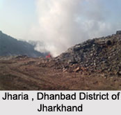
 Jharia, a town situated in the Dhanbad district of Jharkhand in eastern India. Geographically the town is located between 22.3° North latitude and 86.7° East longitude at a height of 7 metres (252 feet) above mean sea level. Jharia is situated at the center of the Damodar River Valley and is famous all over the world for its rich coal fields. Kolkata is situated at a distance of 250km. in the northwest of Jharia and Delhi is located at a distance of 1150 km. southeast of Jharia. This colliery center is situated about 170 km. from Jamshedpur. Located on the outskirts of Dhanbad the nearest railway station from Jharia is the Dhanbad Junction Railway Station.
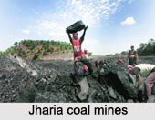 The Damodar Valley is spread over an area of 110 square miles (280 square km.) and produces bituminous coal suitable for coke. The town is a major commercial center as most of India`s coal comes from Jharia. A number of steel companies such as Tata Steel, IISCO and SAIL have taken the coalfields on lease in Jharia. Jharia is the core of prime coke coal in the country and consist of twenty-three large underground and nine large open cast mines.
The India Census report, which came out in 2001 states that Jharia had a population of 81,979. The male population has been enumerated to be 54% of the population and females` account for 46% of the population. In Jharia, 14% of the population is less than six years of age. The census report also brings out the literacy rate of the town, which is 68%. This is a progressive trend because the national average literacy rate is 59.5%. To be specific, the male literacy rate is 74% and the female literacy rate is 60%.
