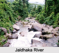
 The Jaldhaka River is a trans-boundary river, located both in India and its neighboring country Bangladesh. More specifically, India is the prime location of this river, whereas Bangladesh is the secondary location of this river.
Geography of Jaldhaka River
Globally, Jaldhaka River can be pinpointed at coordinates 27.0297 degrees north and 88.8747 degrees east.
Course of Jaldhaka River
The course of the River Jaldhaka has a length of about 192 kilometers. This river originates from the Kupup (also known as Bitang Lake), a small glacial lake in southeastern Sikkim in the eastern Himalayas. It is formed by the union of three streams namely, Bindu Khola, Dudh Pokhri and Jaldhaka. The location of the confluence is Bindu, which is a small hamlet or the last village on the Indian side bordering Bhutan in the Darjeeling district of West Bengal. A riverine boundary is thus formed by this river with India and Bhutan on the left bank. It journeys through Bhutan and three districts of West Bengal namely, Darjeeling, Jalpaiguri and Cooch Behar. In the district of Cooch Behar, the river takes the name Singimari. The river enters Bangladesh through the Lalmonirhat District. It then amalgamates with the Dharla River and is therefore known as the Dharla. The Dharla heads towards the Brahmaputra River near the Kurigram District. The river traverses only for a small length in Bangladesh. The river thus can be said to journey over several international borders.
Tributaries of Jaldhaka River
The Murti, Naksal Khola, Sutunga and Jarda are known to be the prominent tributaries of the Jaldhaka River meeting it at its right bank in the lower reach. Major tributaries joining the river at the left bank are the Diana, Rehti-Duduya and Mujnai.
Significance of Jaldhaka River
The entire watershed of the Jaldhaka River is considered to be the most fertile agricultural zone along with the Teesta Basin. The upper course is famous for crops like ginger, medicinal herbs and fruits like oranges and pomegranate. The middle course comprising of Jalpaiguri district is entirely tea and corn dominated and the lower course is filled with the harvesting of rice, jute and tobacco. The inter river formed lands are cultivated with crops like bamboo and mat sticks. In the lower basin, the inter river lands are cultured with banana.
Development of Jaldhaka River
Development of Jaldhaka River took in terms of Jaldhaka Dam. This dam is located in Bindu over the Jaldhaka River. It was constructed with the purpose of generating electricity. Presently, the dam site has developed into a tourist attraction.
Visiting Information
The nearest rail station to Jaldhaka is Malbazar. Jaldhaka can be reached from Siliguri (90Kms) and from Kalimpong (135Kms). The Jaldhaka river valley area can be reached on road. One is then advised to travel west to east through the arterial Dooars road of NH 31, to reach Khunia crossing situated between Chalsa and Nagrakata. From the Khunia crossing the road running north will lead to the Jaldhaka area about 20 km ahead.
Related Articles:
Water Resources in India
Indian Rivers
Dams in India
Lakes of India
Estuaries of India


