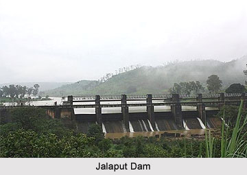
 Jalaput Dam, built across the Machkund River of Orissa, stands as a boundary between the states of Orissa and Andhra Pradesh. The dam is situated near Ondra Gadda in the district of Visakhapatnam and is placed along the Mudugal hills. The dam has a steep fall along it known as the Duduma Falls. The Jalaput Dam has been functioning from the year 1955 and it holds around 34.273 TMC of water under the Machkund Hydro-Electric Scheme (MHES), down stream.
Construction of Jalaput Dam
The name Jalaput is basically a tribal name which has acquired its name putting together the two words Jal and Put. The word Jal means water and Put means store house. As Jalaput Water Reservoir provided water to many of the local tribes the dam came to be known as the Jalaput Dam. The area used to be a dense forest comprising of a river and tribal villages before the dam was constructed 55 years ago. Jalaput is also a village, bordering the two states, Orissa and Andhra Pradesh. This bridge makes a distinction between the two states. The bridge in the Visakhapatnam district of Andhra Pradesh is known as LF, whereas the bridge in Koraput district of Orissa is called the RF. The Jalaput RF Bridge belongs to the Koraput District, while the LF Bridge belongs to the Visakhapatnam district of Andhra Pradesh.
Before the Jalaput Dam was constructed, this bridge was known as Tentaput. Many tribal villages are still seen along the bridge. The triangular shape of the hydro-electric project is formed by Jalaput, Machkund and Onukadelli. This hydro-electric power station in Jalaput provides electricity to Vishakhapatnam and Vijaywada in Andhra Pradesh and Jeypore in Orissa.
Development of Jalaput Dam
The main occupation among the people residing in and around the area of Jalaput is agriculture. Apart from agriculture wood cutting has also gained prominence as an occupation in the present days. The business activities in the area around Jalaput are mostly dominated by Telugu speaking businessmen and only a few Oriya business personnel. The agrarian business of the area is flourished by rice, jawa and some medicinal plants. In the recent years Jatropha plantation and tissue culture has also gained primacy to a large extent.
The communication system of Jalaput is quite developed. It is well connected with all the major towns of Orissa and Visakhapatnam in Andhra Pradesh by road. During the winter season large number of tourists flock the region. The famous Araku Valley is only 60 km from the Jalaput Dam.


