 Jagatsinghpur District is one of the thirty districts of Odisha, which is located in eastern part of India.
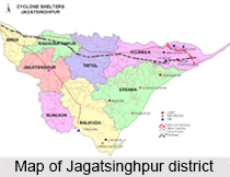
Location of Jagatsinghpur District
Jagatsinghpur District is situated on an elevation of 15 metres (49 feet). It is the smallest district in the state and covers a landmass of 1759 square kilometres. The place lies between 86 degree and 3 minutes to 86 degree 45 minutes East Longitude and between 19 degree 58 minutes to 20 degree 23 minutes north latitude.
History of Jagatsinghpur District
History of Jagatsinghpur comprises of the conglomeration of Hindu, Muslim, Maratha and British realms. The Maratha administration kept the place under their jurisdiction and appointed Jagat Singh in 1748 to collect revenue. He collected the Peshkush and Nazrana and remained an unchallenged and uninterrupted administrator for a pretty long period. The place was converted from Hariharpur to Jagatsinghpur after the name of Jagat Singh since 1786. Consequent to the bifurcation of old Cuttack District into four new districts, the Jagatsinghpur District was created on 1st April 1993. The new district was inaugurated by the then Chief Minister Biju Patnaik in an auspicious ceremony. The foundation stone to the District Collectorate was laid in November 1995 by the then Deputy Chief Minister Basant Kumar Biswal and it was inaugurated in November 1997.
Geography of Jagatsinghpur District
Jagatsinghpur District is bounded by Kendrapara district in North, Puri district in the South, Bay of Bengal in the East and Cuttack district in the West. It enjoys a temperate climate. Winter is cold, while summer is hot and humid. The four major rivers of Odisha irrigate the mainland of Jagatsinghpur. These are the Mahanadi River, Kathajodi River, Devi and Biluakhai. The district is prone to cyclonic rainfalls during the monsoons. The cyclone of 1999 caused maximum damage in this district.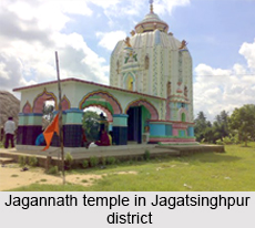
Administration of Jagatsinghpur District
Jagatsinghpur city is the district headquarters of Jagatsinghpur District. It is the smallest district in the state and covers a landmass of 1759 square kilometres.
Demography of Jagatsinghpur District
Jagatsinghpur District has the minimal demography. So that it has the good margin of literacy rates. With 88.5 percent rate of male literacy and 68.5 percent of female literacy, the district ranks better than the national average in literacy and is one of the developed districts in Odisha. The district tops the list in male literacy in Odisha.
Economy of Jagatsinghpur District
The economy of the Jagatsinghpur district is dependent on agriculture. Agriculture is the main occupation of bulk of the population. The key crops of the district are paddy, sugarcane, turmeric, cotton and jute. Processing, manufacturing, repairing and fisheries industries also contribute towards the economic development. Jagatsinghpur is a leading district of the state in terms of industrialization. Paradip, a modern deep water port, was built here in the 1960s and has now become a hot business destination due to the large foreign direct investment. The port town of the district has already emerged as the one of the country"s major investment hot spot by attracting investments. The Petroleum Chemicals and Petrochemical Investment Region (PCPIR) which has spread over 284 square kilometres (110 sq mi) in the area.
Related Articles
Odisha
Temples of Odisha
Districts of Odisha
Puri, Odisha</b>
Lulung, Odisha
Forts in Odisha
Crafts of Odisha


