 Irrigation in India is a technique in agriculture involving supply of controlled amount of water to plants at regular intervals. Various factors like soil, topography, rivers (perennial or non-perennial) and rainfall distribution and conditions determine the sources of irrigation in India. Different sources of water available for irrigation in India are rain, underground water, rivers, springs, etc. Rain water is considered to be one of the most ideal sources of irrigation, if in case it is timely as well as adequately received. Among all the methods of increasing the cultivation of crops in India, irrigation is regarded as the most effective method. It is important to note that after independence of India, stress on the construction of several irrigation systems continued and are given due importance.
Reasons for Using Irrigation in India
It is important to note that rainfall is uncertain, uneven and prominently seasonal in India. Even during the rainy season it does not rain for the adequate period. Failures of adequate rain have brought miseries in several areas of the country. It is not unknown that farmers in India have suffered several miseries because of the failure of sufficient and timely rains. Rainfall in India varies in different regions of the country. Some areas only receive moderate rainfall. As a result, the crops may get badly affected. Therefore, apart from rainfall other sources of water are tapped for successful cultivation of crops. Also, India experiences a long dry period. Thus, irrigation is necessary in India and especially important in those areas of the country, which are likely to suffer from droughts due to very less rainfall. It will reduce the dependence of farmers on monsoons. It is important to note that the improved variety of manures and seeds cannot alone increase the crop yield in the absence of required amount of water. This gives yet another reason for the utilization of irrigation as an agricultural technique. 
Significance of Irrigation in India
Irrigation in India helps in adequate and timely supply of water, which helps in proper growth of the crops. It can help in the increase of production of crops, that is, both food and cash crops. Moreover, by applying the method of irrigation more varieties of crops can be raised. Secondary crop can be raised during the dry period of the country with the help of irrigation. Thus, Irrigation in India plays an important role in enhancing food security. Job opportunities in rural areas can also be resultantly enhanced.
Traditional Means of Irrigation in India
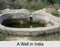
Traditional Means of Irrigation include wells, tube wells, ponds, rivers, etc. A well is an excavated structure in the ground. It is created by digging, driving, boring or drilling to get groundwater. A tube well is a structure in which a long and wide stainless steel tube or pipe is bored into an underground aquifer. The mechanism of a tube well helps to lift water up for irrigation via a pump. A pond contains standing water. It can be natural as well as artificial.
A river generally contains freshwater moving towards an ocean, sea, lake and another river. Some rivers progress into the ground and become dry at the end of their course. Such rivers do not meet another body of water.
A large number of minor and traditional irrigation methods are only found in India and not in any other region of the world. Even today, the minor irrigation procedures are used extensively. Wells and tanks that were built for irrigation in the ancient age continue to exist even today.
Major Sources of Irrigation in India
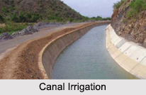
Major Sources of Irrigation in India are tanks, canals, wells, springs, etc. A tank is a structure created by building a small bund of earth or stones across a stream and is helpful in water storage. The water which the bund holds is utilized for irrigation. Canals are man-made structures created for supplying water. India has two types of canals namely inundation canals, (which utilize excess water of rivers during floods) and perennial canals (which are created by adding some form of barrage across the river).
Besides irrigation, other methods that can increase the crop cultivation in India comprise usage of plant nutrients, improved seeds, improved agricultural procedures and pesticides.


