 Indian Transport system helps in visiting, exploring and integrating different parts of the country. It helps in establishing communication among the citizens and merging the social, cultural and economic aspects of a nation. Various goods are also supplied from one place to another through roadways, railways, airways and waterways. Indian transport system improved immensely with the introduction of different means of transportation and vehicles in the market. These means of transportation are described below.
Indian Roadways
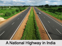
Indian Roadways network is known to extend over 5,472,144 kilometers (3,400,233 miles). As of 31st of March, 2015, the network attained the distinction of being the second largest road network in the world. Types of roads in India are varied. Indian roads have been classified as national highways, state highways, other PWD (public works department) roads, rural roads, urban roads and project roads. India has a network of national highways connecting all the major cities and capitals cities. Highways form the backbone of the Indian economy. Many towns have sprung up along major highways of India.
Indian Railways
Indian Railways is regarded as the 4th longest and the most profoundly used network in the entire world. Owned by the Government of India, Indian Railways carry out rail operations throughout the country. The railway has a route of about 66,687 km. It has developed a wide variety of trains for the passengers. They are the toy trains, luxury trains, express trains or long-distance trains, metro railways like Kolkata Metro and Delhi Metro. Metro is a mass rapid transit system operational in cities of Mumbai, Kolkata, Chennai and Delhi. The first rapid transit system in India, Mumbai Railway, was established in 1867.
Indian Airways
Indian Airways is the fastest means of transport in India. Rapid economic growth is making air travel more and more affordable in India. It is important to note that there are about 346 civilian airfields in India, out of which 253 have been labeled as paved runways and 93 have been labeled as unpaved runways. As of November 2014, about 132 airfields have been declared as airports in India. Several Indian airlines link Indian cities with other cities in the country. Foreign airlines link Indian cities with major cities across the world. Apart from airports, there are heliports in India. 45 heliports have been recorded in India, as of 2013. India has world`s highest helipad at the Siachen Glacier, at a height of about 6400 meters (21,000 ft) above mean sea level.
 Indian Inland Waterways
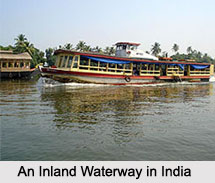
Indian Inland Waterways exist in the form of rivers, canals, estuaries, backwaters, creeks, etc and is widespread throughout the country. Also, there are 111 National Waterways in India. The network of national waterways is spread about 20,275.5 km. These waterways serve the purpose of inland water transport. The total navigable length is around 14,500 km, out of which about 5200 km of rivers and about 4000 km of canals can be used by mechanized crafts. Boats and launches serve lesser distances through rivers and canals.
Vehicles forming the base of Indian Transport
In ancient times, people used to carry out walking tours on foot and thus covered long distances. Walking is still the most common mode of transportation in rural India. Animals were used as effective means of transportation before technological advancement in India. Bullock carts were invented and consequently came horse carts. Some of the other vehicles forming the base of Indian Transport are described below.
Indian Palanquins
Indian Palanquins or "palkee" was one of the luxurious methods of transport used in India by the rich and nobles. In ancient times, it was primarily used to carry the deity or idol of different Gods. Much later in the 15th century, palkee was introduced as a popular form of transportation in which the girls/ ladies from rich families were ferried and were escorted by males, riding on horses.
Indian Bicycle Rickshaws
Indian Bicycle Rickshaws are popular and exist since ancient times. They are still used in rural India. In urban areas, auto rickshaws have mostly superseded them. Bicycles, motorbikes and mopeds driven by engines are also a common sight in both rural and urban areas of India.
Indian Trams
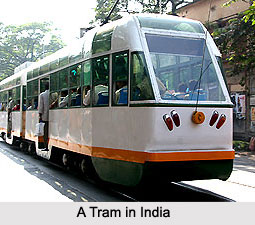
 Indian Trams occupy a nostalgic place in the mind of Indians. The beginning of the British rule in India saw trams being introduced in many cities like Mumbai and Kolkata. However, tram is not obsolete and is still seen in Kolkata.
Indian Buses
Indian Buses carry over 90 percent of public transport in the cities of the country. Indian transport is incomplete without the service of buses in a plethora of routes all across the nation. All classes of society use buses. They are a cheap and easy mode of transport. The government is also promoting the use of buses since it reduces the number of vehicles on the roads, thus reducing traffic jams.
Indian Taxis
Indian Taxis are also used immensely in different Indian cities. Taxis can either be hailed or are hired from taxi stands. Following the regulations of the Indian government, all taxis need to have a fare-meter installed.
Indian Cars
Indian Cars form a part of the private vehicles in India. In India, private vehicles comprise about 30 percent of the total transport demand in urban areas. It is important to note that there is a very low rate of car ownership in India.


