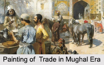
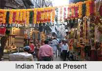
 Indian Trade significantly affects national income of the country. From ancient times till the establishment of British Empire, India was famous for its tremendous wealth. Even during the medieval period, that is, roughly from the 12th to the 16th centuries, the country was prosperous despite the frequent political disturbances. A notable feature of Indian trade was the growth of towns in various parts of the country. This development was the result of political and economic policies followed by the Muslim rulers. These towns entered Indian trade and industrial centers, which in turn led to the general prosperity of the nation.
Indian Trade during the Sultanate Period
During the sultanate period from the early 13th to the early 16th centuries, the economy of the towns flourished because of Indian trade. The establishment of a sound currency system based on the silver tanka and the copper dirham took place. Ibn Batuta, the 14th century Moorish traveler visited India during the sultanate period. He had described Delhi as a major trade center in those days. He has made descriptions about the teeming markets of the big cities in the Gangetic plains, Malwa, Gujarat and southern India. The important centers of Indian trade and industry were Delhi, Lahore, Bombay, Ahmedabad, Sonargaon and Jaunpur. Coastal towns also developed into flourishing industrial centers with huge populations.
Indian Trade during Mughal Rule
Indian Trade during Mughal Rule coincided with the establishment of a stable center and a uniform provincial government. During Mughal rule from the 16th to the 18th centuries, Indian trade received further impetus. During this age of relative peace and security, trade and commerce flourished. The burgeoning foreign trade led to the development of market places not only in the towns but also in the villages. The production of handicrafts increased in order to keep up with the demand for them in foreign countries. The prime urban centers of Indian trade during the Mughal era were Agra, Delhi, Multan, Lahore, Thatta and Srinagar in north India. The important cities in west India were Ahmedabad and Patan in Gujarat, Bombay, Surat and Ujjain. The flourishing trade centers in eastern India were Dacca, Patna, Hoogly, Chittagong and Murshidabad. The accounts of Indian trade contain descriptions of a wide variety of exquisite goods sold in the markets of those days. India was known widely for its textiles, which formed one of the chief items of export.
Indian Trade at Present
At present, Indian trade with almost all the countries of the world has reached its zenith, along with domestic trade. Different communities dominate Indian trade in various parts of the country. Multani and Punjabi merchants control business in north India. In Gujarat and Rajasthan, business is in the hands of the Bhats. Foreign traders from Central Asia known as Khorasanis are also known to be engaged in trade all over India. The Indian trade scenario has far exceeded its imports both in the number of items as well as in volume. Thus, India had always enjoyed a favorable balance in trade relations with other countries. It"s earning from the export of textiles, sugar, spices and indigo has increased significantly. Well-maintained roads connecting various parts of the country facilitate domestic trade.
Products of Indian Trade
Hardwood furniture embellished with inlay work is forever a popular item in Indian trade. The furniture was modeled on the European design but the expensive carvings and inlays are inspired by the elaborate Mughal style. The Indian artistry is one of the most eye-catching features in Indian trade. Indian arts and crafts have been patronized by Indian rulers. They were unmatched in their beauty and skill and were popular in the European countries. They still have their impact on Indian trade. Indian trade at domestic level started in medieval India. The most superior quality rice and sugar from Kannauj, wheat from Punjab and betel leaves from Dhar in Madhya Pradesh found their way to the markets of Delhi.


