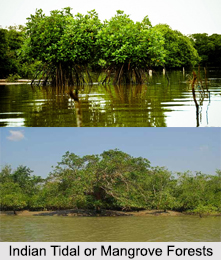
 Indian Tidal or Mangroves Forests is the home of low and medium height of various types of trees. The swamps protect coastal areas of India and home to so many species of Aquatic Birds, water animals and reptiles. Apart from the Sunderbans in West Bengal, the swamps of Karnataka Western Ghats, Konkan, Gujarat and mangroves of Kollam are few more sites of wetland in India. The Indian Tidal or Mangrove Forests are generally submerged, particularly on river deltas. The mangrove forests are one of the most productive and bio-diverse wetlands on earth and they grow in the inter-tidal areas and estuary openings between land and sea.
The Indian Tidal or Mangrove Forests are most luxuriant around the mouths of large rivers and in sheltered bays and are found mainly in areas, where annual rainfall is fairly high. The Indian tidal or mangrove forests fix more carbon dioxide per unit area than phytoplankton in tropical oceans.
Besides the Sunderbans, there is other Tidal or Mangrove Forests in India, which are as follows:
Mangrove Forests of Sunderban
Mangrove Forests of Sunderban are mainly situated on the Gangetic Delta and in Coastal Plains in West Bengal. They are called the "Sunderban", which in Bengali, literally translates to Beautiful Forest. It presents an excellent example of ongoing ecological processes and is world famous for its wide range of flora and fauna.
The Mangrove Forests of Sunderbans has been designated as a UNESCO"s World Network of International Biosphere Reserves, since 2001. It has also been recognised as a UNESCO World Heritage Site, since 1997 and been named as Sunderban National Park.
 Bhitarkanika Mangroves, Odisha
Bhitarkanika Mangroves is India"s second largest forest, located in Odisha. Bhitarkanika is created by the two river delta of Brahmani and Baitarani River and one of the important Ramsar Wetland in India.
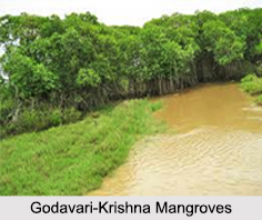
Godavari – Krishna Mangroves, Andhra Pradesh
The Godavari-Krishna Mangroves lie in the delta of the Godavari and Krishna rivers in Andhra Pradesh. Mangroves eco-region is under protection for Calimere Wildlife and Pulicat Lake Bird Sanctuary.
Pichavaram Mangroves, Tamil Nadu
Pichavaram Mangrove is one of the largest mangroves in India, situated at Pichavaram near Chidambaram in Tamil Nadu. Pichavaram ranks among one of the most exquisite scenic spots in Tamil Nadu and home of many species of Aquatic birds.
Baratang Island Mangroves, Andaman
Baratang Island Mangroves is a beautiful swamp, located at Great Andaman and Nicobar Islands. Mangrove Swamps of Baratang Island are situated between Middle and South Andaman.
Ecosystem of Indian Tidal or Mangrove Forests
The ecosystem of the Indian tidal or mangrove forests is a complex one. The mangrove forests provide critical habitat for a diverse marine and terrestrial flora and fauna. The healthy mangrove forests are considered as key to a healthy marine ecology.
The plants in these forests include trees, shrubs, ferns and palms and these plants are mainly found in the tropics and sub-tropics on riverbanks and along coastlines. The plants are unusually adapted to anaerobic conditions of both salt and fresh water environments. All these plants have nicely adapted to the muddy, shifting, saline conditions and they mainly produce stilt roots that project above the mud and water in order to absorb oxygen. The mangrove plants also form communities that help them to stabilise banks and coastlines and also to provide natural habitat to many types of animals.
The Indian Tidal or Mangrove Forests are indeed an integral part of the entire ecosystem in India.


