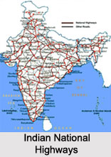
 Indian National Highways are essentially long-distance roadways that are maintained by the Central Government. The length of the Indian National Highways is about 100,087 km, in addition to over 1,000 km of limited-access expressways. These highways serve to connect all the major cities and capitals cities of India. Though they make up about 2 percent of the road network, the highways carry almost 40 percent of the total national traffic. Most of the highways are two-laned with paved roads. They might be broader in developed areas with up to 4 lanes and in large cities they can go up to 8 lanes. These roads are well-maintained in the developed Indian states and are free of potholes. Very few Indian National Highways are made of concrete. About 19,064 km (11,846 mi) of the National Highway system still consists of single-laned roads.
National Highways Authority of India
National Highways Authority of India (NHAI) was constituted following the National Highways Authority of India Act, 1988. It is responsible for the development, maintenance and management of the National Highways entrusted to it and for matters connected or incidental thereto. The authority became functional in February, 1995. It succeeds the previous authority called the Ministry of Surface Transport.
Historical Development of Indian National Highways
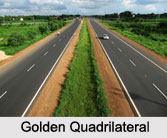
In ancient times, the ruling monarchs had established brick-laden roads in their cities. In the 19th century, the British upgraded the highway network along with building roads on treacherous terrains such as the Western Ghats. After the British, the Government of India launched major initiatives to upgrade and strengthen National Highways. National Highways Authority of India was mandated to implement National Highways Development Project (NHDP) which is India`s largest ever highway project. This project included the Golden Quadrilateral (GQ) and the North–South and East–West Corridor (NSEW). The project aimed to provide world class roads with uninterrupted traffic flow. The four-lane Golden Quadrilateral highway project covers a length of about 5,846 km. It is important to note that some of the busy National Highway sectors in India have been converted to 6 or 4 lane expressways for example, the Delhi-Agra expressway, Delhi-Jaipur expressway, Ahmedabad-Vadodara expressway, MumbaiPune expressway, Mumbai-Surat expressway, Bengaluru- Mysuru expressway, Bengaluru-Chennai expressway and Chennai-Tada expressway.
Indian National Highways
 The most famous highway of medieval India was the Grand Trunk Road. The Grand Trunk Road begins in Sonargaon near Dhaka in Bangladesh and ends in Peshawar in Pakistan. It travels through important Indian cities such as Patna, Varanasi, Kanpur, Agra, Delhi, Panipat, Pipli, Ambala, Rajpura, Ludhiana, Jalandhar and Amritsar. The longest National Highway in India is the National Highway 7, which runs from Varanasi in Uttar Pradesh to Kanyakumari at the southernmost point of the Indian mainland in Tamil Nadu. It covers a distance of about 2369 km. It passes through metro cities like Jabalpur, Nagpur, Hyderabad and Bengaluru. The shortest National Highway is the National Highway 47A. It covers a total distance of about 4 km and runs from Ernakulam to Kochi. It is important to note that India has the distinction of having the world`s highest drivable highway connecting Manali to Leh in Ladakh, Kashmir. Some of the other important Indian National Highways are the National Highway 1 which connects New Delhi to the Pakistan border, National Highway 2 which runs from Uttar Pradesh border to the Jharkhand border, National Highway 4 which runs from Pune to Bengaluru, National Highway 17 which runs from Sevoke in West Bengal to Guwahati in Assam and National Highway 21 which runs from Punjab to Haryana.
Significance of Indian National Highways
Indian National Highways form a very important part of the economic backbone of the country. More specifically, they facilitate trade, commerce and tourism in India. They are of immense significance today due to the diminishing borders for creating a global world. They often help to facilitate some major developments along their routes. For example, many new towns have sprung up along the major Indian National Highways. Also, these highways have a large number of small restaurants and inns (known as dhabas) along their length, which serve popular local cuisines and serve as truck stops.


