Indian Mountains of the Northern Region includes some of the famous mountain ranges of the North India, a home calling to the various Mountain vegetations, species of animals, birds and trees.
 Aravalli Mountain Range
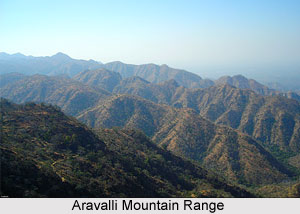
This is the oldest mountain ranges in India and runs for approximately 800 kms. It runs across Rajasthan in a northeast to southwest direction and the northernmost end of the range runs into Haryana and ends near Delhi. The highest peak of the Aravallis is the Guru Shikhar peak at Mount Abu. It rises to almost 1722 metres near Gujarat.
Karakoram Mountain Range
The Karakoram Range, lying in the state of Jammu and Kashmir, has over 60 peaks that stand at a height of over 7000 metres. Found here is the K2, the second highest peak in the world. Close to the north-western end of the Karakoram lays the Hindu Raj range and beyond this is the Hindu Kush Range. The Karakorams are bound on the South by the Gilgit, Shyok and Indus River.
 Himalaya Mountains
For centuries, these mountains have protected the nation`s borders from invading armies. The most dominant mountain ranges in the country are the Himalayan Mountain Ranges. The Northern side of the Indian Subcontinent is defined by the Himalaya Mountains, the Hindukush and the Patkai Ranges. Himalaya Mountains are the highest mountain range in Asia that separates India from the Tibetan plateau. It is known as the King of mountains. The Himalayas have got their name from the Sanskrit word, Himalaya a tatpurusa compound meaning "the abode of snow" (from hima "snow" and alaya "abode"). Kalidasa has described the Himalayas, as the `King of mountains, enclosing divinity that stands between the two oceans as measuring rod as were, of the earth. The Indian Himalayas can be divided into three zones - the Shivalik Hill or the Outer Ranges on the southern wing, the Middle Ranges like the Pir Panjal and the Dhauladhar, and the Greater Himalayas with the highest and oldest peaks (many of these are in Nepal).
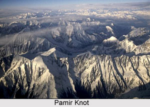
The Great Mountain Wall of the North Pamir knot lies in Central Asia, not far from India. It is often referred to as `the roof of the world`. From this knot emerge numerous mountain ranges. One of them is the Kunlun, which travels eastwards into Tibet. Another range, i.e. the Karakoram, enters Kashmir and runs southeast and incorporates the plateau of Aksai Chin. It broadens further east and is called the Kailash Range in Tibet. The Karakoram are majestic mountains comprising K2, the second highest mountain peak of the world. The Karakoram Pass has now gained extraordinary prominence. There are huge glaciers, i.e. highly sluggish rivers of solid ice and snow, in this region. The Baltoro and the Siachen are some of the legendary glaciers of this area.
 Shivalik Hills form a belt, which runs continuously from Jammu, Kangra valley, Sirmur district to Dehradun and finally ending up in the Bhabbar tracts of Garhwal and Kumaon. The Shivaliks extends about 1,689 km from southwest Kashmir through northern India into southern Nepal. The hills consist of 6000 meters of layered rocks. They are known as the sub-Himalayas or the foothills and were formed by the erosion caused by the rise of the Himalayas.
Along the southern edges of Himachal Pradesh , from the Kangra valley to the Sirmaur regions the Shivalik hills are all developed. In the valleys between the Shivalik and the main northern ranges are located the Doon valleys. Dehradoon has emerged out to be the best-known towns of the Sivalik regions and also an important tourist hub.
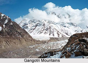
Gangotri Mountains are a subsection of the Garhwal Himalayas, which is located in the northern state of India, Uttarakhand. The well-known Gangotri glacier and several peaks well known as religious destination or for their difficult climbing routes are located here. Some of the popular peaks of the Gangotri Mountains include Chaukhamba, Kedarnath, Thalay Sagar, Meru, Shivling peak and Bhagirathi.


