Home > Indian History > Geography of India > Indian Mountains of Eastern Region
Indian Mountains of Eastern Region
Indian mountains of eastern region are innumerable and popular tourism spots in the country.

Share this Article:

Indian mountains of eastern region consist of the different mountain ranges and hills located in the states of Eastern India like West Bengal, Bihar, Jharkhand and Orissa.

Mountains of West Bengal
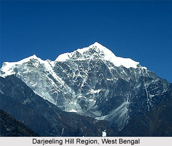
Darjeeling Himalaya Hill regions, Falut, Poobong, Tonglu, Sandakfu, Singalila Ridge are the innumerable mountains and peaks which are present in the state of West Bengal. The Himalayan region comprises Singalila Range which has a height of 3636 meters, Darjeeling-Kurseong range which measures 2600 metres, Chola range which measure 1704 metres and Buxa-Jayanti range which measure about 1400 metres. Other hills involve Ayodhya Hills in Purulia that measure 855 metres, Biharinath in Bankura which measures 451 metres, Susunia which measure 448 metres and is located in Bankura. The hillocks are Mukutmanipur which is 200 metres in length, Mama Bhagne Hillock which has a height of 105 metres and hillock of Eastern Kolkata which has a height of 20 metres. Other hills are Tonglu hills, Tiger Hills, Ghum Hills, Deolo Hills, Gorbabu Hills, Durpin Hills, etc.

Mountains of Bihar
Bihar consists of hills like Rajgir Hills, Barabar Hills, Kaimur Range which is about 483 kms in length, Brahmayoni Hills, Pretshila Hills and Ramshila Hills.
Indian Mountains of Eastern Region Mountains of Jharkhand
Mountains of Jharkhand are Parasnath Hills near Gomoh which is 3,544 feet, Dubaur in Kodarma which measures 1,970 feet, Singarsi Peak in Sahibganj which measures 1,503 feet, Kotwar Pahar in Kalikapur which is about 1,503 feet, Lapsa Baru in Chaibasa which measures 1,044 feet, Trikut Parvat in Jamtara which is 1,033 feet and Sideshar in Mushabani which measures 817 feet are the various mountains located in Jharkhand.

Mountains of Orissa
Orissa boasts of several mountains like Singaraja Mountain in Saroda which measures 4,631 feet, Nimgiri near Balangir, which is 4,002 feet, Megasini in Jajpur which measures 3,819 feet, Ganpati Pahar near Jajpur which measures 3,655 feet, Chata Danda in Jajpur which measures 3,635 feet, Amjhori Hills near Jajpur which measure 3,550 feet, Mankarnacha near Talcher which measures 3,374 feet, Deva Giri near Phulbani which is about 3,165 feet, Balia Pahar near Bolanikhodan which measures 3,117 feet, Mahendra Giri near Sorada which measure 2,898 feet, Betjharana Parbat in Bhadrakh which measure about 2,717 feet, Raegara Hills in Asika which measure 2,137 feet, Thakurani Pahar in Bada which measure 2,066 feet, Goaldei in Buguda which measure 1,935 feet, Banspani Pahar in Barabil which is 1,829 feet, Bola in Jajpur which is 1,667 feet and Malayagiri in Talcher which measure 1,627 feet.


Share this Article:

Related Articles

More Articles in Geography of India


Geography of Uttar Pradesh
The fourth largest State in India UP is located in the Northern part of India whose area is 2,36,286 sq Kms.
Geography of Maharashtra
Covering an area of 308,000 sq. km, Maharashtra, the third largest state in India.
Geography of Kerala
Geography of Kerala includes plains, hills, valleys and coasts. With the Arabian Sea in the west, the Western Ghats in the east and networked by several rivers, Kerala enjoys diverse geographical features.
Geography of West Bengal
The geography of West Bengal is unique with high peaks of the Himalayan range in the north, the Bay of Bengal in the south and the remaining region is covered with both plains and plateaus.
Geography of Jharkhand
Geography of Jharkhand is comprised of the rich mineral resources and the highly agricultural prospect in this state.
Geography of Sikkim
Geography of Sikkim is characterised by a vast array of magnificent hillock that extends from one corner of the state to the other.
Geography of Meghalaya
The suitable climate, highland plateaus, rivers and the flora and fauna together forms the geography of Meghalaya.
Geography of Mizoram
Mizoram is surrounded by hills, valleys, rivers, waterfalls and lakes. The hills range from 1000 meters to 2000 meters. Rivers, lakes and waterfalls also play major role in forming the land of Mizoram.
Geography of Jammu & Kashmir
Jammu and Kashmir is encompassed by valleys. Some of the dominant valleys of the state are Kashmir Valley, Tawi Valley, Chenab Valley, Poonch Valley, Sind Valley and Lidder Valley etc. Jhelum River is the only major Himalayan River which flows through the Kashmir valley. Indus, Tawi, Ravi and Chenab Rivers are the major ones flowing through the region.
Geography of Daman and Diu
Daman and Diu is situated on the west coast of India and are the smallest union territories of India.
Geography of Goa
Geography of Goa occupies a prime location along the Konkan coastal belt on the western coast of India. The state is bordered by Maharashtra in the north and Karnataka in the south. The Western Ghats in the east contribute to the flora and fauna of Goa.
Geography of Arunachal Pradesh
Geography of Arunachal Pradesh reveals that it is a hilly tract nestled in the foot of Himalayas.
Geography of Kutch
Geography of Kutch District is covering an area of 45,612 km. Kutch District is the largest district in the state of Gujarat.
Geography of Ladakh
Geography of Ladakh mainly comprises the huge Karakoram Range with long stretch of cold desert which mark the region separately from the rest of the states of Indian subcontinent. Surrounded with the mountain ranges from all corners this small region separates Indian subcontinent from rest of the Asian continent.
Geography of Rajasthan
Geography of Rajasthan defines the dry topography with arid climate of the western mountain region.
Geography of Tamil Nadu
The Indian state of Tamil Nadu is located in the Northern hemisphere in the hot zone.