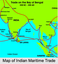
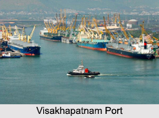
 Indian Maritime Trade depends on water bodies of the country. India is almost an island as far as trade is concerned. It is important to note that there is limited trade by land with the country`s neighbors and the bulk of the trade is seaborne. India derives its potential strength from being strong at sea. India is perhaps the only country whose name has been attached to a great ocean. The country also shares maritime boundaries with seven nations in the Indian Ocean. Its strategic geographical position with a long coastline acts as a great advantage in the maritime trade field. About 90 percent of India`s international trade by volume and about 77 percent by value are carried by sea. Also, India`s exports had gradually increased from approximately 75 percent in 1990-1991 to around 86 percent in 2001-2002, compared to imports, thereby increasing the importance of Indian Maritime Trade.
History of Indian Maritime Trade
Indian Maritime Trade History is replete with instances, which highlight Indian trade spreading to the eastern and the western parts of the world through the nation`s seafaring people and the oceans. India`s place among the great maritime trade nations was well recognized by the country`s foresighted ancestors. It was with the arrival of the Mughals, the landlocked tribe of Central Asia, that importance of the seas was forgotten. India paid a heavy price for it, becoming a prey to the advancing maritime colonial powers like the British East India Company. Early voyages of British East India Company relates to the trade business of the British, which expanded to India as well.
 Indian Maritime Trade via Indian Ocean
Indian Ocean comprises of one fifth of the water surface of the earth, peopled by a third of the world`s population. With Indian Ocean and even the Bay of Bengal administrating and aiding in Indian maritime trade to a significant level, the country can never fall short of seaborne business and profit. India has been a grand maritime nation with a strategic geographical position in the Indian Ocean. The Indian Peninsula juts into the Indian Ocean, covering major shipping lanes of the world, providing the shortest route between the Atlantic Ocean and the Pacific Ocean. Indian trade taking place through the sea-lines of communication (SLOC) or maritime trade routes join the major regions in the western and eastern part of the world. Seaborne trade passing through the Indian Ocean has amounted to almost 15 percent of the entire world trade.
Significance of Indian Maritime Trade
Indian Maritime Trade helps in earning foreign exchange. India`s export of merchandise goods during 2002-2003 was valued, US 51.7 billion dollars, thereby crossing the crucial milestone of US 50 billion dollar mark for the first time. Indian maritime trade has prospered, which can be comprehended from the growth rate achieved in the export of merchandise goods. According to World Trade Organization reports for the calendar year 2002, India achieved 15 percent growth rate in the export of merchandise goods and this growth rate was the second highest in the world next to China, which achieved 22 percent growth rate. India being primarily a country with an enormous coastline, Indian maritime trade has a lion`s share in the annual economic growth report.


