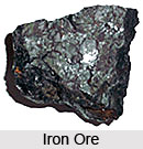
 William A. Burt, of United States discovered iron ore on September 19, 1844. Iron ore is mined in about 50 countries. The seven largest of these producing countries account for about three-quarters of total world production. Australia and Brazil together dominate the world`s iron ore exports, each having about one-third of total exports.
Iron (Fe) is a metallic element and composes about 5% of the Earth`s crust. When pure it is a dark, silvery-gray metal. It is a very reactive element and oxidizes (rusts) very easily. The reds, oranges and yellows seen in some soils and on rocks are probably iron oxides. The inner core of the Earth is believed to be a solid iron-nickel alloy. Iron-nickel meteorites are believed to represent the earliest material formed at the beginning of the universe. Studies show that there is considerable iron in the stars and terrestrial planets: Mars, the "Red Planet," is red due to the iron oxides in its crust.
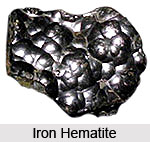
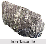
Iron is one of the three naturally magnetic elements; the others are cobalt and nickel. Iron is the most magnetic of the three. The mineral magnetite (Fe3O4) is a naturally occurring metallic mineral that is occasionally found in sufficient quantities to be an ore of iron. The principle ores of iron are Hematite, (70% iron) and Magnetite, (72% iron). Taconite is a low-grade iron ore, containing up to 30% Magnetite and Hematite.
 Hematite is iron oxide (Fe2O3). The amount of hematite needed in any deposit to make it profitable to mine must be in the tens of millions of tons. Hematite deposits are mostly sedimentary in origin, such as the banded iron formations (BIFs). BIFs consist of alternating layers of chert, hematite and magnetite. They are found throughout the world and are the most important iron ore in the world today. Their formation is not fully understood, though it is known that they formed by the chemical precipitation of iron from shallow seas about 1.8-1.6 billion years ago, during the Proterozoic Eon.
 Taconite is a silica-rich iron ore that is considered to be a low-grade deposit. However, the iron-rich components of such deposits can be processed to produce a concentrate that is about 65% iron, which means that some of the most important iron ore deposits around the world were derived from taconite. Taconite is mined in the United States, Canada, and China.
The human body is 0.006% iron, the majority of which is in the blood. Blood cells rich in iron carry oxygen from the lungs to all parts of the body. Lack of iron also lowers a person`s resistance to infection. It is estimated that worldwide there are 800 billion tons of iron ore resources, containing more than 230 billion tons of iron. It is estimated that the United States has 110 billion tons of iron ore representing 27 billion tons of iron. Iron ore is the raw material used to make pig iron, which is one of the main raw materials to make steel. While the other uses for iron ore and iron are only a very small amount of the consumption, they provide excellent examples of the ingenuity and the multitude of uses that man can create from our natural resources.
Uses of Iron
 Powdered iron is used in metallurgy products, magnets, high-frequency cores, auto parts, and catalyst. Radioactive iron is used in medicine, tracer element in biochemical and metallurgical research. Iron blue used in paints, printing inks, plastics, cosmetics especially eye shadow, artist colors, laundry blue, paper dyeing, fertilizer ingredient, baked enamel finishes for autos and appliances, industrial finishes. Black iron oxide mostly used as pigment, in polishing compounds, metallurgy, medicine, and magnetic inks, in ferrites for electronics industry. The ore is filled in purifying tank through which gases are passed and purified.


