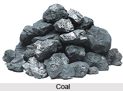
 Coal is by far the most abundant fossil fuel on earth. It is essentially carbon and is mainly used as a combustion fuel. As the number of industries increased, demand for more sources of energy grew.
Coal is the product of plants, mainly trees that died tens or hundreds of millions of years ago. Due to water logging in low-lying swampy areas or in slowly sinking lagoons, dead trees and plants did not decompose as they normally would. The dead plant matter was covered with water and protected from the oxidizing effect of air. The action of certain bacteria released the oxygen and hydrogen, making the residue richer and richer in carbon. Thick layers of this carbon-rich substance, called peat, built up over thousands of years. As more material accumulated above the peat, the water was squeezed out leaving just carbon-rich plant remains. Pressure and temperature further compressed the material. This aided the process of producing coal as more gases were forced out and the proportion of carbon continued to increase. The carbon slowly metamorphosed into coal over millions of years.
There are three main types of coal: lignite, bituminous, and anthracite. Lignite and bituminous have a lesser percentage of carbon in them and therefore burn faster. They release a great deal of pollutants into the atmosphere. Anthracite has about 98% carbon and therefore burns slowly and releases much less smoke. Coal of all types contains sulphur to some degree. Sulphur is the worst of the pollutants and causes damage to human health and to vegetation. Though petroleum gained importance over the 20th century and continues to do so, coal remains essential for the industrial sector. It is the principal heat source for electricity generation in most countries and is used directly in such heavy industries as iron and steel making.
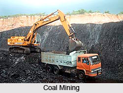
Until recently, most coal came from underground mines. But now there are a large number of opencast mines. Underground coalmines are notorious killers due to roof falls and explosions. Accidents have resulted in the deaths of hundreds of miners. Almost 80% of today`s coal comes from surface strip mines (opencast mines), which is much safer. Huge earth-moving equipment strips off the soils and rocks covering the buried coal seams. The land is backfilled and returned to normal after the coal has been removed, thereby repairing the landscape. But most companies do not refill the excavated area and leave it damaged. Most countries have now enforced backfilling by law.
Coal mining in India
 India has about seven per cent of the world`s proven coal reserves. Coal supplies more than 50% of the country`s total energy requirements. By current estimates, the reserves are enough to meet India`s needs for at least another 100 years. Coal mining in India dates back to the 18th century. The regulation of its use in the industrial sector was conceived in 1923. In 1972-73, the Indian government nationalized the coal industry, primarily to develop the sector, since it was considered to be of strategic importance for rapid industrial development. India`s coal demand is expected to increase several folds within the next 5-10 years due to the completion of ongoing coal-based power projects, and demand from metallurgical and other industries.
Coal is the dominant source of fuel in the industrial sector, with a share of nearly 72.5% in the total energy consumption. The industrial sector is the largest consumer of electricity, with a share of 41% of the total consumption. The transport sector is the largest consumer of petroleum products, and accounts for nearly 50% of the total consumption. The small amount of coal presently consumed adds atmospheric pollutants, some of which precipitate into the ground and water. This assault on the environment has been the cause of heavy pollution in many areas of the world.


