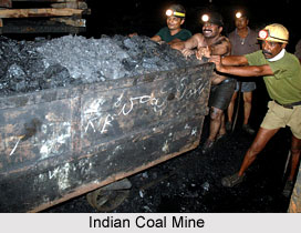
 Besides being prime source of industrial energy; it is also a raw material. It is an indispensable input in steel and chemical industries. Coal, inclusive of lignite, even today accounts for 67 per cent of the country`s commercial power requirements.
The coal deposits in India, to the tune of 98 per cent belong to the Gondwana age. Nearly three-fourths of the coal deposits are located in the Damodar River Vallev. The places well associated with these deposits are Raniganj, Jharia, Giridih, Bokaro and Karanpura.
Minerals are exhaustible sources and hence need to be conserved. The efficient utilisation, recycling and application of improved technology for extraction and purification will help in conserving minerals. The other river valleys associated with coal deposits are the Godavari, Mahanadi, Son and Wardha. Other coal mining areas are in the Satpura range and in Chattisgarh plains of Madhya Pradesh. The coalfields of Singreni in Andhra Pradesh, Talcher in Orissa and Chanda in Maharashtra are also very large.
Coal mining in India started at Raniganj in West Bengal in 1774. After Independence the entire coal mining was taken over by the State from private hands to avoid exploitation of labour. The major coalfields after their regrouping are (1) Raniganj, (2.) Jharia, (3) East Bokaro and West Bokaro, (4) Panch-Kanhan, Tawa Valley, (5) Singrauli, (6) Talchar, (7) Chanda-Wardha, and (8) Godavari Valley.
Reserves and Production
The Geological Survey of India, according to its surveys till 1998, has put the country`s proven coal reserves at nearly 206,239.5 million tonnes. These are based on the seams of 0.5 metre and above in thickness and only to a depth of 1200 metres below the ground surface. The major states known for coal reserves are Bihar, Orissa, West Bengal, Madhya Pradesh, Andhra Pradesh and Maharashtra. By and large, the quality of Indian coal is rather poor in terms of their capacity to give heat. However, the poor quality coal can be converted into electricity and gas. This is the reason why many of our thermal and super thermal power stations are located on the coalfields and the- electricity produced is fed into large regional grids. This cuts down time and expenditure involved in transportation of coal to its consumption points.
The coal production in India, which was just 32.30 million tonnes in 1951, has now jumped to over 318.98 million tonnes. Thus the per capita consumption of coal has increased from 135 kg to nearly 400 kg.
Lignite, also called brown coal, is generally a low quality coal. But the Indian lignite has less ash content than coal, and is consistent in quality. The deposits at Neyveli in Tamil Nadu are of the order of 3,300 million tonnes. Total reserves have been estimated at 27,500 million tonnes. The mines, however, suffer from the artesian structure and constant pumping of water is a formidable task. But the location of these deposits is a boon for Tamil Nadu. It produces 600 mw of thermal power. The industrialization of the State depends considerably on the thermal power generated at Neyveli lignite field. In 1997-98 the total production of lignite in the country was 18 million tonnes.


