Located on NH 17, Indapur is a city in Pune district of the western state of India, Maharastra. Indapur is located in the south of Kolad, which is in Raigad district at a distance of 12 km. Indrapur is situated, 16 km north of Goregaon and about 30 km from Birvadi. The nearest airport is the Pune Lohegaon Airport and Chhatrapati Shivaji International Airport and the nearest railway stations are the Indapur railway station on the Roha-Chiplun rail line on the Konkan Railways and the Baramati railway station. Geographically, the town is located between 18.12° North latitude and 75.03° East longitude at a height of 527 metres (1728 feet) above mean sea level.
he India census report published in 2001 states that Indapur had a population of 21,584. Males account for 52% of the population and females comprises of 48% of the population. In Indapur, 14% of the 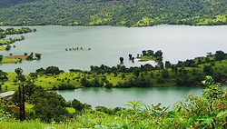 population is less than six years of age. The average literacy rate of Indapur is 69% which is greater than the national average literacy rate of 59.5%. To be specific, the male literacy rate is 75% and the female literacy rate is 62%.
Indapur has a hot climate receiving very little rainfall. The main crops cultivated here are wheat , sugarcane and jowar. Some important industries like sugar and iron industries are located here.
Dholwal Dam, Ghosala Fort, Kolad Museum, Torna Fort, Khadakwasla Lake and Mulshi Lake are popular tourist destinations easily accessible from Indapur. The Shetfal Lake,a water reservoir in the district is also located here.
