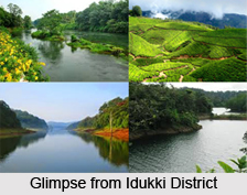
 `Idukki`, the name of the district is supposed to be derived from the Malayalam word `Idukku` which means a narrow ravine. Its main magnetism lies in its Mountains, Valleys, dams, wildlife sanctuaries, Hill Stations and beautiful lakes.
The population of this district mainly consists of tribal people. Munnar hill station is one of the best-attracted places in Idduki. There are nearly 14 peaks and among them Anamudi peak is the highest which towers over 2695 metres. Among the exotic flora found in the forests and grasslands in this region is the Neelakurinji, this flower that enwraps the hills in blue every twelve years, will bloom next in 2006 AD.
Thekkady in Idukki is one of the finest wildlife reserves in India. This district is often considered as a `Paradise` with its entire natural grandeur. This district is only accessible by road where Rail and Airline is just a dream. NH 49 and State highways 13 and 33 passes through the district. There are some places in Idukki that are not even accessible by Roads.
Location:
This place is located in the middle part of Kerala. The four borders of the District can be described, as on the East there is Madurai District of Tamil Nadu while on the West it is covered by Ernakulam and Kottayam Districts of Kerala. In the South it is the Pathanamthitta District, while on the North it is bound by Trichur and Coimbatore Districts of Kerala and Tamil Nadu States respectively.
It lies between 9 degree 15` and 10 degree 21` of north latitude and 76 degree 37` and 77 degree 25` of east longitudes.
Idukki covering 13 percent of the state usually ranks first among the other districts in the state in respect of area. It has the area of 5,087 sq.km, which extends by 115 km. from south to north and 67km. from east to west.
Topography and Geography:
Idukki has many unique topographical and geographical characteristics. Idukki is the largest District of Kerala with a vast area of 5105.22 sq.km. Rugged mountains and forests cover about 97 percent of the total area. There is only a strip of Middle land i.e. 3% in the western part of the district. The low land area is totally absent while more than 50% of the total area of the district is covered by forest.
 The pattern of the land which is above 20m-100m sea level is mainly Midland and the total percentage of this type of land is about 4.5. The Mid-upland ranges from 100m-300m whose total percentage of land area is almost 7.5, upland is above 300m-600m above sea level and the total land area is 12.1. The Western Ghat High Range is above 600m-1200m sea level and the total percentage of land area is 48.3, while at 1200m and above there is Top Western Ghat High Range where the total percentage of land area is 24.5.
There are 14 peaks in the district, which exceed a height of 2000 meters above Main Sea Level. They are Anamala, Eravimala, Tathumala, Chenthavara, Kumarickal, Karimkulam, Devimala, Perumal, Ghudoor, Kabhula, Devicolam, Anchanad, Sabarimala and Karimala. The estimated height of the Anamala peak is 2817 meters. As the district lies mostly in the highland, it is covered with dense forest, steep hills, and deep valleys. Because of the rising and falling topography large area of the district is not suitable for scientific cultivation.
Rivers:
Some of the significant rivers of the district are Periyar, Thodupuzhayar and Thalayar. Periyar is the second longest river of Kerala, which is 277 km. Long. It originates from Sivagiri in the southeast part of the district and touches all the taluks of the district. The Periyar is exploited at various points in its course with a view to generate electricity and for irrigation purpose. Mullaperiyar dam, Idukki Hydro-electric project, Idamalayar Hydro electric project and the proposed lower periyar are constructed across the Periyar.
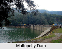
Kundala Dam, Mattupetty Dam, Munnar head works, ponmudi dam and the kallarkutty Dam are constructed across the various tributaries of Periyar. There are a few natural lakes in the district, which can be mentioned as Eravikulam, and Devikulam lakes in Devikulam taluk and Elavizhapunchira in Thodupuzha taluk. Two types of the soil are found in the district. The highland area is covered by forest soil or alluvial soil and the other parts by laterite soil.
Climate:
The climatic changes in the district undergo a sudden variation as we go from West to East. The western parts of the district mainly comprising of midland area experiences moderate climate, whose temperature varies between 21degree C to 27 degree C. while the eastern parts located in the highland have a comparatively cold climate with temperature varying between minus 1degree C to 15 degree C in November-January and 5 degree C to 15 degree C during March-April.
 Discussing about rain in the district it can be said that it receives plenty of rains from both the Southwest monsoon during June-August and the Northeast monsoon during October- November. The normal rainfall is 3265 mm. As common to other parts of the state, the Idukki district also experiences both the southwest monsoon or Edavappathy and North-East Monsoon or Thulavarsham during June-July, which is more predominant and experiences maximum rainfall and also during October -November respectively.
The annual rainfall in the district varies from 250 to 425 cms. The western region of Devicolam taluk gets more rainfall, which goes even up to 500cms. The Eastern and Northeastern regions of the district get very low rainfall normally up to 150 cms. Munnar, Devikulam Pallivasal, Vellathooval etc. are some of the well-mentioned places experiencing high rainfall.


