Home > Indian History > Geography of India > Hunting in Mughal India
Hunting in Mughal India
Hunting in Mughal India was a rampant activity that was practiced by the emperors, forest tribes and common people too.

Share this Article:

Hunting in Mughal India
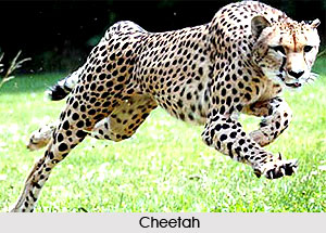
Hunting in Mughal India was practiced keeping the older traditions as the basic rule thereby adding new important features. Hunting was forbidden on certain days. Though there were efforts against slaughter. Under Mughal rule, no killing was allowed at sacred sites of the Jains. Species like elephant and cheetah were being hunted on a large scale. The behaviour of the falcons, tribal`s hunting techniques and various methods to track down tigers were the striking features. The hunting grounds had few restrictions. Methods like the capture of cheetahs in pit-fall traps or the trapping of francolins were innovative techniques.

The second nature of the Mughals was the use of the musket. Hunting was more than a means of pleasure. Hunts were used to camouflage armed expeditions. The Mughals developed hunting into a ritualized activity. Animals are often hunted with huge attendants of soldiers, who drove the game animals into a central stage. The half-moon formation that was formed by the troops required a deep knowledge of the terrain and quarry movements. Despite all the arrangements, the hunters moved on foot and exposed themselves to personal danger when pursuing a lion or tiger. As the Mughals were keen meat-eaters they were particular about observing what they required.

Jahangir had killed over 17,000 animals in the first twelve years of his reign. The Mughal palate used thirty five to forty meat dishes at a proper meal. The hunt symbolized the of the ruler`s ability to overcome harmful animals. The tiger and the lion played a key role for the Mughals. The lion figured in the flag of the Mughal Empire and was common enough across the scrub forests and dry savannahs of Northern India.

This article is a stub. You can enrich by adding more information to it. Send your Write Up to content@indianetzone.com


Share this Article:

Related Articles

More Articles in Geography of India


Geography of Uttar Pradesh
The fourth largest State in India UP is located in the Northern part of India whose area is 2,36,286 sq Kms.
Geography of Maharashtra
Covering an area of 308,000 sq. km, Maharashtra, the third largest state in India.
Geography of Kerala
Geography of Kerala includes plains, hills, valleys and coasts. With the Arabian Sea in the west, the Western Ghats in the east and networked by several rivers, Kerala enjoys diverse geographical features.
Geography of West Bengal
The geography of West Bengal is unique with high peaks of the Himalayan range in the north, the Bay of Bengal in the south and the remaining region is covered with both plains and plateaus.
Geography of Jharkhand
Geography of Jharkhand is comprised of the rich mineral resources and the highly agricultural prospect in this state.
Geography of Sikkim
Geography of Sikkim is characterised by a vast array of magnificent hillock that extends from one corner of the state to the other.
Geography of Meghalaya
The suitable climate, highland plateaus, rivers and the flora and fauna together forms the geography of Meghalaya.
Geography of Mizoram
Mizoram is surrounded by hills, valleys, rivers, waterfalls and lakes. The hills range from 1000 meters to 2000 meters. Rivers, lakes and waterfalls also play major role in forming the land of Mizoram.
Geography of Jammu & Kashmir
Jammu and Kashmir is encompassed by valleys. Some of the dominant valleys of the state are Kashmir Valley, Tawi Valley, Chenab Valley, Poonch Valley, Sind Valley and Lidder Valley etc. Jhelum River is the only major Himalayan River which flows through the Kashmir valley. Indus, Tawi, Ravi and Chenab Rivers are the major ones flowing through the region.
Geography of Daman and Diu
Daman and Diu is situated on the west coast of India and are the smallest union territories of India.
Geography of Goa
Geography of Goa occupies a prime location along the Konkan coastal belt on the western coast of India. The state is bordered by Maharashtra in the north and Karnataka in the south. The Western Ghats in the east contribute to the flora and fauna of Goa.
Geography of Arunachal Pradesh
Geography of Arunachal Pradesh reveals that it is a hilly tract nestled in the foot of Himalayas.
Geography of Kutch
Geography of Kutch District is covering an area of 45,612 km. Kutch District is the largest district in the state of Gujarat.
Geography of Ladakh
Geography of Ladakh mainly comprises the huge Karakoram Range with long stretch of cold desert which mark the region separately from the rest of the states of Indian subcontinent. Surrounded with the mountain ranges from all corners this small region separates Indian subcontinent from rest of the Asian continent.
Geography of Rajasthan
Geography of Rajasthan defines the dry topography with arid climate of the western mountain region.
Geography of Tamil Nadu
The Indian state of Tamil Nadu is located in the Northern hemisphere in the hot zone.