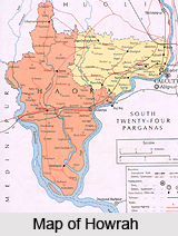
 Howrah or Haora is an industrial city and a municipal corporation in the Howrah district of West Bengal. Howrah is located on the west bank of the Hooghly River. It is a twin city of Kolkata; the two cities are connected by the Howrah Bridge (also known as Rabindra Setu), the Vidyasagar Setu (also known as the second Hooghly Bridge) and ferry services between various jetties in the two cities. It is West Bengal`s second largest city in terms of both area and population. The name of Howrah is derived from the word Haor, Bengali term for a wetland, which is typically a depression land where water and mud accumulates.
Howrah Station serves as a terminal for two railway zones of India, namely the Eastern Railway and the South Eastern Railway. There are six other railway stations within the city, including the railway junction at Santragachhi and the terminal at Shalimar Station; all the six belong to the South Eastern Railway network. Two national highways, namely the NH 2 and NH 6 are connected to Vidyasagar Setu via Kona Expressway. Bengal Engineering College is presently a prestigious university of the city.
History of Howrah, dates back to 500 years when Venetian explorer Ceasare de Federici traveled India during 1565-79. He mentioned a place called Buttor in his journal circa 1578. Following his description, Howrah was the place up to which large ships could travel (in the Hooghly River) and so, it was the dock for loading and unloading goods for those ships. This place is specialised with the modern day neighbourhood Bator of Howrah.
In 1713, the Bengal Council of British East India Company, on the accession of the Emperor Farrukhsiyar, grand son of Aurangzeb, to the throne of Delhi, sent a deputation to him with a petition for a settlement of five villages on west bank of Hooghly river along with thirty-three villages on the east bank. The five villages on the west bank on Hooghly river were `Salica` (Salkia), `Harirah` (Howrah), `Cassundeah` (Kasundia), `Ramkrishnopoor` (Ramkrishnapur), and `Battar` (Bator). These places were identifiable with localities of modern day Howrah city. In 1787, the Hooghly district was formed, and till 1819, the whole of the present day Howrah district was added to it. The Howrah district was separated from the Hooghly district in 1843.
The establishment of the Howrah Railway Terminus in 1854 started the most important phase of its industrial development. Flourmills were established in 1855 and several more Jute mills around 1870s. The Howrah-Shalimar Railway Section and the Shalimar Terminus were constructed in 1883. The light engineering industry grew up after 1914.
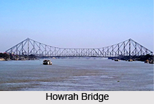 By 1914 almost every major city in India was served by the Railways and the increased demand for its rolling stocks and repair works resulted in the establishment of railway workshop in Howrah. Today, Howrah is famous for Howrah Station and Howrah Bridge.
Howrah is an industrial city, famous for various kinds of industries. Burn Standard Company is a major company in heavy engineering industry, which is now part of Bharat Bhari Udyog Nigam Limited. Jute industry suffered during the Partition of Bengal (1947), when the larger jute production area became part of East Pakistan (now Bangladesh). The foundry industry saw a decline in demand due to growth in steel industry. Howrah is known today as an engineering hub and known as Sheffield of the East.
Howrah station is a major railway station serving Howrah, Kolkata and the other neighbouring districts. It was established in 1854; railway line constructed here connected it to the coalfields of the Bardhaman. This station is now part of two zones of Indian Railway, the Eastern Railway and the South Eastern Railway and it is connected to most of the major cities of India. Hooghly River flows between the twin cities of Howrah and Kolkata. The picturesque Howrah Bridge (Rabindra Setu), a beam bridge with one endpoint next to Howrah station, and Vidyasagar Setu, a cable-stayed bridge with one endpoint near Shalimar station, connects the two cities. Both the bridges are counted among the longest ones in the world within their types. Also, between various jetties in Howrah and Kolkata, there are ferry services available, which were introduced during the 1970`s.
Total road length in Howrah is approximately 300 km. Grand Trunk Road starts from Indian Botanical Gardens in Howrah. This road was built by the Public Works Department of the British administration. Howrah has eventually become a place of tourist interest. Shibpur is a neighbourhood in south Howrah, near Vidyasagar Setu. Through the centuries it has been synonymous with the Great Banyan tree. The Great Banyan Tree boasts of having the largest canopy in the world.
 This tree continues to grow and covers many city blocks and looks like a forest. The British established the Indian Botanical Gardens in 1786 between the Great Banyan Tree and the Hooghly River. Situated in Shibpur, The Bengal Engineering College is the second oldest engineering college in India.
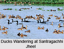
There is a famous Rama Temple in Ramrajatala area of Howrah, where Rama is worshiped for 4 months, starting from Rama Navami to the last Sunday of the month of Shravana. A big fare is held annually on the last day of worship. The Santragachhi Jheel is a large lake that attracts migratory birds during winter. It is located near Santragachi Railway Station. Lesser Whistling Duck is the most dominant species visible here. Forest Ministry of the State Government of West Bengal intends to convert the lake to a `wildlife conservation centre`.
For complete business listing of Howrah visit Howrah Yellowpages
