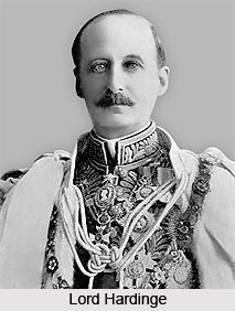
 A plan for a rail system in India was first put forward in 1832, but no further steps were taken for more than a decade. In 1844, the Governor General of India Lord Hardinge allowed private entrepreneurs to set up a rail system in India. Two new railway companies were created and the East India Company was asked to assist them. The first train in India became operational in 1851.
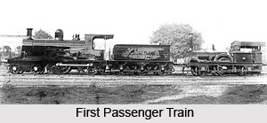
A year and a half later, on 1853 the first passenger train service was inaugurated between Bori Bunder Bombay, and Thane. Covering a distance of 34 km (21 miles), it was dragged by three locomotives, Sahib, Sindh and Sultan. This was the formal birth of railways in India. The formal inauguration ceremony was performed on 16th April 1853, when 14 railway carriages carrying about 400 guests left Bori Bunder "amidst the loud applause of a vast multitude and to the salute of 21 guns."
 The first passenger train steamed out of Howrah station destined for Hooghly, a distance of 24 miles, on 15th August 1854. Thus the first section of the East Indian Railway was opened to public traffic, inaugurating the beginning of railway transport on the Eastern side of the sub-continent. In south the Madras Railway Company opened the first line on 1st July 1856. It ran between Veyasarpandy and Walajah Road, a distance of 63 miles. In the north a length of 119 miles of line was laid from Allahabad to Kanpur on 3rd March 1859. These were the humble beginnings which in outstanding path developed into a network of railway lines all over the country.
By 1880 the Indian Railways system had a route mileage of about 9000 miles. The British government encouraged new railway companies supported by private investors under a scheme that would guarantee an annual return of five percent during the initial years of operation. Once established, the company would be transferred to the government, with the original company retaining operational control. The route mileage of this network was about 14,500 km by 1880, mostly spreading inwards from the three major port cities of Bombay, Madras and Calcutta. By 1895, India had started building its own locomotives, and in 1896 sent engineers and locomotives to help build the Railways.
Soon various independent kingdoms built their own rail systems and the network spread to the regions that became the modern day states of Assam, Rajasthan and Andhra Pradesh. A Railway Board was constituted in 1901, but decision-making power was retained by Lord Curzon, the Viceroy of India. The Railway Board operated under the guidance of the Department of Commerce and Industry and had three members, a government railway official serving as chairman, a railway manager from England and an agent of one of the company railways. For the first time in its history, the Railways began to make a tidy profit. In 1907, almost all the rail companies were taken over by the government.
The following year, the first electric locomotive appeared. With the arrival of the First World War the railways were used to meet the needs of the British outside India. By the end of the First World War, railways had suffered immensely and were in a dilapidated condition. The government took over the management of the Railways and removed the link between the financing of the Railways and other governmental revenues in 1920, a practice that continues to date with a separate railway budget.
The Second World War severely weakened the railways as trains were diverted to the Middle East and the railway workshops were converted into war ammunition workshops. At the time of independence in 1947, a large portion of the railways went to the then newly formed Pakistan. A total of forty-two separate railway systems, including thirty-two lines owned by the former Indian princely states, were merged as a single unit, which was named as the Indian Railways.
The existing rail networks were abandoned in favour of zones in 1951 and a total of six zones came into being in 1952. As the economy of India improved, almost all railway production units were diagnosed. By 1985, steam locomotives were phased out in favour of diesel and electric locomotives. The entire railway reservation system was streamlined with computerisation in 1995.


