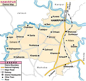
 Hamirpur District of Uttar Pradesh forms a part Chitrakoot Division. This district lies between 25 degree 7 minutes north and 26 degree 7 minutes north latitude and longitude 79 degree 17 minutes east and 80 degree 21 minutes east including Mahoba District. Hamirpur is bounded by district Jalaun (Orai), Kanpur and Fatehpur District in north, Banda District in east, Mahoba in south and Jhansi District and Jalaun District in the west. Total area occupied by Hamirpur District covers 4,121.9 sq kms. Hamirpur town is the district headquarters.
History of Hamirpur District
Early history of Hamirpur District is vague and unclear. This district was initially a part of Bundelkhand region till 1819. In 1823, Hamirpur was made a separate district. Hamirpur District played a significant part in the country`s freedom movement. Early inhabitants of this region were the Chedis. This region was also ruled by Gupta Dynasty.
Geography of Hamirpur District
 In the southern portion of Hamirpur District, numerous outcrops of gneiss rocks, tending to cluster into low ranges. Hamirpur District is surrounded by uneven broken tracts and covered for the most part with small forests. Geography of Hamirpur District does not cover much hilly area. Yamuna River and Betwa River are the two main rivers flowing through the district. Yamuna River forms the northern boundary of the district. The river first touches the district at village Haraulipur in tehsil Hamirpur, where it forms a sudden loop. Its length in Hamirpur District is approximately 56 km. Betwa River flows along the north-western border of the district. It enters the district near Beri village and flows through tehsils Rath and Maudaha. Its length in Hamirpur district is approximately 65 km. Other rivers flowing through the district are Dhasaan, Barma, Ken, Chndraval and Pandwaha. The district has intensely hot summer and a pleasant cold season. The summer season from March to mid of June is followed by the south-west monsoon season from mid-June to the end of September. October and first half of November constitute the post-monsoon period. The cold season is from mid-November to February. May and June are generally the hottest period of the year and maximum temperature in May is about 43 degree Celsius and minimum is around 28 degree Celsius. The heat during the summer season is intense.
Economy of Hamirpur District
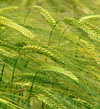
Economy of Hamirpur District is agrarian in character. Near about 27.7 percent land is irrigated land in Hamirpur. Canals are the main source of irrigation and are constructed by the different rivers like Yamuna, Betwa, Dashan, Barma, Ken River, Chandrawal and Pandwaha. Gram, Wheat, Barley, Rice, Bajra, Peas, Arhar and Masoor are the main crops cultivated in Hamirpur District.
Tourism in Hamirpur District
There are several tourist places in Hamirpur District. In fact, there is no dearth of tourism sites in this district. Singh Maheshwari Temple, Meher Temple, Chaura Devi Temple, Gayatri Tapubhumi, City Forest, Kalpa Vriksha, Brahamanand Dham, Bake Bihari Temple, Gayatri Shakti Peeth and Nirankari Ashram are some of the main attractions offered by Hamirpur District.
Hamirpur District is one of the popular tourist destinations of the state.


