 Hailakandi District was declared as the 24th district of Assam in 1989 by a Government of Assam. It is situated at the southernmost corner of Assam. The district Headquarter is 350 km away from the state capital Guwahati. The district is located at the Centre of Barak Valley. It is bordered Barak River in North, Mizoram in the South, Cachar district in the East and Karimganj in the West. The inter-state border of the district stretches over 76 KM in the south-east.Hailakandi attained the status of a district in 1989. The district has four revenue circles, Hailakandi, Lala, Katlicherra and Algapur. It also has five development blocks viz. Hailakandi, South Hailakandi, Lala, Katlicherra and Algapur. The district has been further divided in to 62 Gaon Panchayats. The district has two numbers of towns- Hailakandi and Lala. Both the towns have elected Urban Local Bodies with 16 Wards in Hailakandi and 10 in Lala.
Several myths are associated with the name `Hailakandi`. In Barak Valley dyke is constructed to protect the local people and land from flood. This dyke is colloquially pronounced as `Ail` or `Hail`. In the Bodokachari language `Kandi` means temporary paddy land and this is how the district came to be known as `Hailkandi` and then as `Hailakandi`. Another myth associated with the name of the district is Sali Paddy is grown abundantly as a staple food crop and from `Sailkandi` the district came to be known as Hailakandi.
History of Hailakandi District
Hailakandi was one of the oldest Sub-Divisions of Assam constituted on 1st June, 1869. Before being formed as a full-fledged district, Hailakandi was a Civil Sub-Division under Cachar district.
Despite Hailakandi`s wearing a modern look, the district is rich in cultural heritage and tradition. The district also bears record of having participated in the Freedom Movement of India. Hailakandi`s role in India`s freedom struggle started right from the Sepoy Mutiny. In 1857 leaders from this region had a valiant fight with the British soldiers at a place called `Ron Tila` at Mohanpur in Hailakandi. Several youths of the district also took part in Gandhiji`s Civil Disobedience Movement and Quit India Movement. Prominent among them are Sanat Das Gupta, Upendra Dhar, Abdul Matlib Mazumdar, Sunil Chakraborty and others.
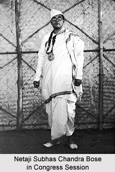
Much of the historical antecedents of Hailakandi can be traced back to the British Rule in India. Water was the only means of transportation till the invasion of the Britishers. It was only during the rule of the Britishers that changes took place in the transport and communication system. The British rulers established many tea gardens and for transportation of raw and finished products, Hailakandi was linked with railway line. Gradually road communication was also developed in the district.. The present Chalmers Higher Secondary School in Katlicherra was set up after the name of Mr. Mac Farlene Chalmers. The Graham M.V. School of Hailakandi was named after Mr. Grahame, the Sub-Divisional Officer of Hailakandi Sub-Division. The present Hertbertganj Bazar was named after Mr. Hertbert, the then SDO of Hailakandi. Besides the contributions of the Britishers, the land donated by some renowned families of Hailakandi for construction of schools still are the flag-bearers of the rich history of the district. Many National leaders including Netaji Subhash Chandra Bose, Jawaharlal Nehru ,Mahatma Gandhi visited the district in the pre-independence period.
Geography of Hailakandi District
Hailakandi District is located in plain and an apparently mountainous region. It maintains a cultural link-up with South East Asia on one hand and mainland India on the other. Total geographical area of the district is 1327 Sq. KM. of which 10.53 Sq. KM falls in urban areas and 1316.47 Sq. KM in villages. The topographical feature of the district is one that is diversified by plains and hills.
Hailakandi district experiences high humidity in hot weather season and heavy rainfall during the rainy season. The average rainfall is 2873 mm and humidity is 85 per cent. In winter climate is cold and dry. There is piercing cold in December and January.
Demography of Hailakandi District
According to the 2011 census Hailakandi district has a population of 659,260. The district has a population density of 497 inhabitants per square kilometer. Its population growth rate over the decade 2001-2011 was 21.44 %. Hailakandi has a sex ratio of 946 females for every 1000 males and a literacy rate of 75.26 %. Bengali is the official language of the District and is spoken by majority of the people. Manipuri is also an important language of the district, spoken by a large minority.


