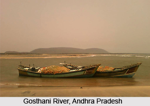
 Gosthani River is an east-flowing Indian river which flows across the southern Indian state of Andhra Pradesh. This river originates from the Ananthagiri Hills which are situated in the Eastern Ghats and eventually flows into the Bay of Bengal.
Course of Gosthani River
Borra Caves is the region through which the Gosthani River flows, for nearly 120 km prior to meeting the Bay of Bengal, through an estuary which is based close to Bheemunipatnam. The Indian districts of Vishakhapatnam and Vizianagram, located in the coastal areas are drained by the river basin of Gosthani River, which follows a dendritic pattern. This river basin is a tiny one which occupies an area measuring about 2000 square kilometres. A major portion of this basin is covered by gneissic rocks and 3 percent of the entire area of the district of Vishakhapatnam is included in this basin. Gosthani River is fed by rainfalls and it is said to enjoy about 110 cm of rainfall, which arrives from the south-west monsoon. The numerous red sand hills near Bheemunipatnam, wherein Gosthani River intersects with the Bay of Bengal resemble the ravines of Chambal. It is believed that these hills had been created over six millennia ago by alterations in the course of the river, immediately tectonic activity. Bhimli is the name of the place where the river meets the Bay of Bengal, and here an estuary has been formed.
Tourism near Gosthani River
Historians have asserted that the confluence of Gosthani and Bay of Bengal is amongst the oldest outposts of the Dutch East India Company in the country. One will notice several historical monuments belonging to the period of the Dutch settlements in India near Gosthani River. Archaeological excavations have been conducted at Gudiwada and Pavuralakonda, close to Bhimli. At Pavuralakonda, ancient Buddhist settlements have been uncovered. This river is said to have provided the regional inhabitants based near Gosthani with safe drinking water while the estuary present at Bhimli used to promote maritime trade and commerce.
Waterworks of Gosthani River
Gosthani River is the main source of drinking water for the local residents of the districts of Vizianagram and Vishakhapatnam. The water of this Indian river have been diverted for commercial as well as agricultural purposes. During the months of summer, numerable infiltration wells are bored onto the bed of Gosthani River to facilitate the extraction of water. During the period from 1963 to 1968, the Thatipudi Reservoir Project empowered with 3 TMC was constructed on this river and it is existent in Vizianagram district, particularly in the region of Gantyada Mandal. About 15, 378 acres of land belonging to Vizianagram is irrigated by Gosthani River which also provides drinking water to the people dwelling in Vishakhapatnam. Chaparai Falls is located on Gosthani River. This river is crossed by the Golden Quadrilateral Highway which connects Vishakhapatnam till Srikakulam. A brand new bridge was established at this area in the year 2003.


