Home > Indian History > Geography of India > Ghataprabha Reservoir
Ghataprabha Reservoir
Ghataprabha reservoir is situated across Ghataprabha River in Karnataka.

Share this Article:

Ghataprabha Reservoir, Karnataka
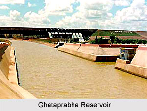
The objective of building the Ghataprabha reservoir across Ghataprabha River in Karnataka, was storing water for irrigational purpose. The Ghataprabha reservoir is a composite dam, which is 53.34 meter high and 10183 meter long. The first stage started in 1897 and comprised a 71 km long left bank canal from the Dupdal weir across Ghataprabha River near Dupdhal in Gokak canal for providing irrigation to an extent of 0.425 lakh hectares. The second stage of the reservoir project comprised left bank canal from the Dupdal weir from 72 km to its full length extension of 109 km across Ghataprabha River, near Hidkal, up to a height of 650.14 meter.

The Ghataprabha reservoir has storage of about 659 Mcum for providing irrigation to a total extent of 1.396 lakh hectares of land, inclusive of the area under stage I. The third stage of the project includes raising the FRL of Hidkal dam to its final level of RL 662.94 meter (RL 2175.00 feet). Thus the gross storage of the reservoir is 1448 Mcum, which is channelized into 202 km long Right Bank Canal and 86 km long Chickkodi Branch Canal.

This article is a stub. You can enrich by adding more information to it. Send your Write Up to content@indianetzone.com


Share this Article:

Related Articles

More Articles in Geography of India


Geography of Uttar Pradesh
The fourth largest State in India UP is located in the Northern part of India whose area is 2,36,286 sq Kms.
Geography of Maharashtra
Covering an area of 308,000 sq. km, Maharashtra, the third largest state in India.
Geography of Kerala
Geography of Kerala includes plains, hills, valleys and coasts. With the Arabian Sea in the west, the Western Ghats in the east and networked by several rivers, Kerala enjoys diverse geographical features.
Geography of West Bengal
The geography of West Bengal is unique with high peaks of the Himalayan range in the north, the Bay of Bengal in the south and the remaining region is covered with both plains and plateaus.
Geography of Jharkhand
Geography of Jharkhand is comprised of the rich mineral resources and the highly agricultural prospect in this state.
Geography of Sikkim
Geography of Sikkim is characterised by a vast array of magnificent hillock that extends from one corner of the state to the other.
Geography of Meghalaya
The suitable climate, highland plateaus, rivers and the flora and fauna together forms the geography of Meghalaya.
Geography of Mizoram
Mizoram is surrounded by hills, valleys, rivers, waterfalls and lakes. The hills range from 1000 meters to 2000 meters. Rivers, lakes and waterfalls also play major role in forming the land of Mizoram.
Geography of Jammu & Kashmir
Jammu and Kashmir is encompassed by valleys. Some of the dominant valleys of the state are Kashmir Valley, Tawi Valley, Chenab Valley, Poonch Valley, Sind Valley and Lidder Valley etc. Jhelum River is the only major Himalayan River which flows through the Kashmir valley. Indus, Tawi, Ravi and Chenab Rivers are the major ones flowing through the region.
Geography of Daman and Diu
Daman and Diu is situated on the west coast of India and are the smallest union territories of India.
Geography of Goa
Geography of Goa occupies a prime location along the Konkan coastal belt on the western coast of India. The state is bordered by Maharashtra in the north and Karnataka in the south. The Western Ghats in the east contribute to the flora and fauna of Goa.
Geography of Arunachal Pradesh
Geography of Arunachal Pradesh reveals that it is a hilly tract nestled in the foot of Himalayas.
Geography of Kutch
Geography of Kutch District is covering an area of 45,612 km. Kutch District is the largest district in the state of Gujarat.
Geography of Ladakh
Geography of Ladakh mainly comprises the huge Karakoram Range with long stretch of cold desert which mark the region separately from the rest of the states of Indian subcontinent. Surrounded with the mountain ranges from all corners this small region separates Indian subcontinent from rest of the Asian continent.
Geography of Rajasthan
Geography of Rajasthan defines the dry topography with arid climate of the western mountain region.
Geography of Tamil Nadu
The Indian state of Tamil Nadu is located in the Northern hemisphere in the hot zone.