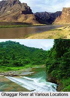
 Ghaggar River is an intermittent river that flows in India and Pakistan. The river flows only during the monsoon season. It rises from the Shivalik Range of northwestern Himachal Pradesh. The river then flows through Pinjore in Haryana to meet River Saraswati. After passing through Ambala and Hissar districts of Haryana, it disappears into the Thar Desert in Rajasthan. This seasonal river feeds two irrigation canals that extend into Rajasthan. The Hakra, which flows in Pakistan, is the continuation of the Ghaggar River in India and they are together called the Ghaggar - Hakra River.
Historical Significance of Ghaggar River
Several historians identify Ghaggar with the Vedic Saraswati River. Along the banks of the Ghaggar River many settlements of Indus Valley Civilization have been excavated. Hence it is believed that the ancient settlements on its banks are the creation of ingenious Vedic Aryan"s.
Drying Up of Ghaggar River
It is believed that Ghaggar-Hakra was indeed a large river that dried up several times. By studying the wide river bed of the Ghaggar River it is observed that some 10,000 years ago, during the great meltdown of the Himalayan Ice Age glaciers, the river flowed full of water. It then continued to flow through the entire region, in the presently dry channel of the Hakra River. Researchers opine that it possibly emptied into the Rann of Kutch. There is also a possibility that it dried up owing to the capture of its tributaries by the Indus system and the Yamuna River.
Some scholars consider 1750 to 1900 BC as the time period for drying of the Ghaggar River. The fact that this time period coincides with the collapse of the Indus civilization encouraged some scholars to link mythological stories of the lost River Sarasvati with the Ghaggar.
Some researchers believe the period at which the river dried up range approximately from 2500 to 2000 BC. There are many archaeological sites of the Indus Valley Civilization along the course of the Ghaggar-Hakra River. But such sites cannot be observed not further south than the middle of Bahawalpur district. It is assumed that the Sarasvati River ended there in a series of terminal lakes. Some historians are of the opinion that its water only reached the Indus or the sea in very wet rainy seasons. However, this notion is contradicted by the satellite images. The images do not show subterranean water in reservoirs in the dunes between the Indus and the end of the Hakra west of Fort Derawar/Marot.
Ancient Tributaries of Ghaggar River
It is believed that rivers Sutlej and Yamuna once flowed into the Ghaggar-Hakra river bed. Both Sutlej and Yamuna have changed their courses several times.


