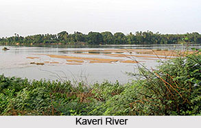
 The soil produced by the tide and flow of River Kaveri is rich and best for agricultural purposes. The floodplain sediments of the Kaveri River in the southern India are derived from Archean gneissic and charnockitic source regions, thus revealing the inter-bedding of silty and sandy units. The geochemistry of silty beds is amazingly uniform at a given location and over a tangential distance of almost 250 km. The sandy beds have more inconsistent chemical compositions, yet are comparable to those of silty beds; the only limitation is the diluting effect of quartz. Silty sediments possess the geochemical signature of prominently exposed source rocks for almost all elements and provide proofs of tectonic unsteadiness in the primary source region.
The floodplain sediments contain all size grades (sand, silt, and clay), which may have resulted in minimizing the bias imposed on underground and bedload sediments due to sorting. The low Chemical Index of Alteration (CIA), the supremacy of undeterred primary minerals, and the minor proportion of smectite clay all suggest that the region has been subjected to the sparse chemical weathering. This is possible if the region has undergone a recent upliftment. The Kaveri river exposes fresh Archean rock to surface denudation. The formation of productive farmland along the Kaveri River course and its delta is associated to these recent geological processes.
The river basin features a wide variety of organisms, many of which are endemic organisms. It is the natural habitat, where many fish varieties including the Mahseer, one of the popular game varieties are also found. The Kaveri River is one of the important rivers in our country. The river and its major tributaries, namely the Kabini, Noyyal, Bhavani, Lokapavani, Amaravathy, Hemavathi and Kapila and others pass through important metropolitan centres like the Bangalore, Mysore, Coimbatore, Trichy and Erode. This river and its tributaries act as a prime source of water to the people of Karnataka and Tamil Nadu. Large-scale water withdrawal and other activities in the river have unfavorably affected the water extent and quality.
The river Kaveri has been sporting a large amount of wildlife. Millions of people in south India are greatly dependent on its water resource especially the tribal population. The water of River Kaveri is widely used for the purpose of irrigation and for the hydral power supply. The hydroelectric plant built on the left Sivanasamudra Falls on the Kaveri, was the first hydroelectric plant in the state of Karnataka.


