 Geography of Sahibganj District includes vast hilly terrains. The vast tract of land enclosed between hill ranges is described with a Persian word `Damin-I-koh` that means `skirts of the hills.` In Sahibganj District, the land on the bank of Ganga River is prolific and richly cultivated. Owing to large scale unscrupulous felling the region once known for its thick and extensive forests is now bereft of much of its forest wealth.
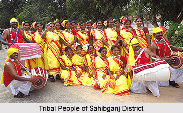
Sahibganj District may be divided into two natural divisions on the basis of its geographical location and cultivable land. First region consists of Borio, Mandro, Barhait, Pathna and Taljhari blocks and lies under Damin-I-koh area. The hills and slopes are covered with forests. The valleys have cultivable lands, yielding mostly paddy. The inhabitants of this region are generally Paharia Tribe, Mal Paharia Tribe and Santhal Tribe. The inhabitants on the hill top cultivate maize by using rain water. The second region consists of Sahibganj District, Rajmahal Hills, Udhwa and Barharwa blocks. This plain region consists of the uplands, undulation along ridges and depressions. The Ganges, Gumani and Bansloi rivers flow through this region. This area has plenty of fertile lands and is highly cultivable.
Ganga River forms the northern boundary of Sahibganj District enters at its north western corner and passes eastward and takes a southward turn forming the southern boundary of the district. Its average width is near about 4 and half kms. It generally swells during the rains and inundates the lowlands lying east of the Railway loop line. There are ferry services across the river between Sahibganj ghat in Sahibganj district on this side and Manihari ghat in Katihar district. Gumani River emerges from the southern region of the Rajmahal hills. It flows in a north-easterly direction up to Barhait valley where it is joined by Mural River. The joint stream takes a south-eastern turn and joins the Ganges a little beyond the district boundary.
Rajmahal Hills are the source of building and road stones. Most of the quarrying is done by the side of the loop line of the Eastern Railway. Pakur chips are quite well known and are used extensively all over Jharkhand, Bihar and parts of West Bengal. The traditional cottage and village industries practiced by the Santhal Tribe and the Paharia Tribe include tasar rearing, carpentry, handloom weaving, rope making, earthen ware making, stone ware making, etc. However, there is no large-scale industry available in the area mainly due to lack of infrastructure support. A number of small-scale industries have been set up in the district. Most of these are based on mining activities. Sahibganj is one of the most important places for trade and commerce in the district. The main imports of the district are linseed, mustard seed, raw cotton, sugar, refined and unrefined molasses, salt, kerosene oil, coal, coke, gunny bags, gram, wheat and maize. The main exports are paddy, jowar, grass, stone chips, hides and fibers.


