 Geography of Rajasthan includes the plain region, plateau region and the hilly sand dunes. It is surrounded by the Aravalli Hills and braided by the sepia luster of the Thar Rajasthan is the largest state of western India.
Geographical Extension of Rajasthan
With an area of 342,239 sq. km. Rajasthan is the largest state of India. The land of Rajasthan is basically defined as a desert but there is more to Rajasthan. What the tourists may not know is that Rajasthan is also surrounded by the Aravalli Hills runs across the state stretching from Mount Abu in the southwest to Kota and Bundi in the east. Thus the landscape of the land is blessed with a diverse geography. On the west and north-west the state is bounded by Pakistan and Punjab; in south by Haryana; in the east by Uttar Pradesh; Madhya Pradesh in the east and south-east and Gujarat in the south and south-west.
Aravalli Range in Rajasthan
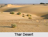
Aravalli ranges in Rajasthan are the oldest chain of mountains in the world. On an average basis the altitude of the state varies from 100-350 meters but in some places the height can reach over 750 meters high. In the southern part of the state the average elevation is higher and the hilly area here is known as Mewar. The mighty Thar Desert lies in the northwest Rajasthan. The desert is famous worldwide for its shifting sand dunes. Jaisalmer and Bikaner are important settlements on routes to the west whereas Jodhpur lies on the edge of this arid zone. This zone also comprise of the northwest region of Barmer, the western part of Nagaur and Churu districts and the southern section of Ganganagar district. The neighboring state of Gujarat also lies in the Thar Desert region.
 Landscape of Rajasthan
The landscape of Rajasthan can also be divided into semi arid zone that extends from the Aravallis in the west. This zone includes parts of the Shekhawati and the Luni River basin. At the eastern part of Rajasthan lie the states of Haryana, Delhi and Uttar Pradesh. This part of the land has fertile plateaus that include regions like Bharatpur, Kota and Bundi. These places are intensively cultivated. Several districts of Rajasthan are part of the Mewar plain area. Bhilwara, Bundi, Tonk, Sawai Madliopur, Dholpur, Ajmer and Jaipur lie in the Mewar area.
Thar Desert in Rajasthan
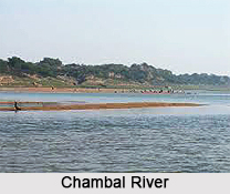
Although a huge expanse of Rajasthan is engulfed by the Thar Desert yet there are water bodies that are instrumental in the survival of the wildlife and the variety of flora that is found here. Banas River and its tributaries are the lifeline for many districts of Rajasthan. These water bodies ultimately join the Chambal River on the border of Rajasthan and Madhya Pradesh. Another river that serves the state is the Mahi River and its tributaries. This eventually flows into the Arabian Sea. The areas of Chittorgarh, Bundi and Ranthambore are also notable for their hills and ridges. These districts lie in the east and the southeast Rajasthan.
 River of Rajasthan
In case the travellers are interested in the yellow sand dunes then they will have to travel to Jaisalmer, the land of yellow sandstones. Chambal is the only perennial river in the state that runs on the eastern border between Madhya Pradesh and Rajasthan. The other river is Luni serves western Rajasthan while Mahi drains the southern part of Rajasthan.
Favourable Climate of Rajasthan
The best season to visit Rajasthan is from October. The climate is at its best during this time. Even the tourists are on a hurricane tour it will not tire them. The bright warm mornings and cold nights are the best time to explore the nook and corner of Rajasthan. The summer months (April -June) are hot with temperature reaching maximum high of 46 C and minimum of 25 C. the onset of monsoon generally takes place between July and September. Though the rainfall is sparse on an average the Aravallis tend to experience a higher rainfall and lower temperature. The interesting geography of Rajasthan makes it a popular haunt for the tourists of both national and international level.


