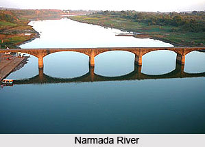
 The surrounding natural landmark forms the geography of Narmada River. The Narmada Valley is one of the vital forms in the geography of Narmada River. Below the Vindhyachal scarps, the narrow valley of the Narmada lies. The River flows across this valley and the valley occupies the southern part of the district in Manawar tahsil and the southeastern part of Kukshi tahsil. The width of the valley is 15 to 30 kilometers. The height varies from 275 meters in the northern part of Manawar tahsil to 150 metres in the low plain of Nisarpur in the southwest. Khalghat and Bakaner lie in the western side of the valley and the valleys is undulation wider, more open and fertile with alluvial cover. Proceeding westwards the valley is embedded with hills alternatively give birth to numerous streams, which join the Narmada along the southern boundary of the district. The result is that there are few stretches and pockets of alluvium silt along the streams.
The River System of Narmada is also credited for its unique geographical features. The southern part of Madhya Pradesh lies in the catchment area of the Narmada River. The river forms the southern boundary of the state. The Chambal and its tributaries drain the northeastern parts of Madhya Pradesh. The Lower course of River Narmada forms the catchment area of the Ganga. The northwestern part drains into the Mahi. The water-dividing line between the Narmada and the Chambal and the Mahi are divided by the offshoot range, which runs along the boundary of Sardarpur-Jhabua.
The Narmada River flows along the southern boundary of the district in a rift valley from east to west with a southerly inclination. It rises from the Amarkantak plateau of the Satpura range in Shahdol district. The river flows to the west it crosses the district at Lasangaon at the confluence with the Karametre It forms the southern boundary of the district along with that of the West Nimar for about 107 Kilometres. It receives the streams including Dob, Boad, Mahali and Goi on its left while the Man, the Karam, and the Bagh on its right bank.
In the central parts of India the river is held to be far more sacred than any other stream in India. Even Ganga herself comes and dips in these waters once a year. She comes in the form of a coal-black cow and dip in these waters once a year. She comes in the form of a coal-black cow and returns home pure white, freed from all sins. A sighting of the Narmada is considered equivalent to a bath in the Ganga. At numerous places along its course there are temples, and fairs are held. Pilgrims perform Pradakshina along the riverbanks while walking along the southern bank from its source to the mouth and going back along the northern bank. The performance is regarded to be of the highest religious value. Roads at Khalghat and Chikhalda in the district cross the river. Ferries supervised by the local administration at important crossings carry out navigation across the river.


