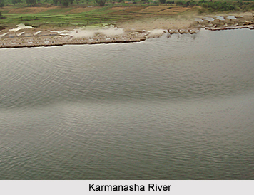
 Geography of Kaimur District in Bihar can be distinguished into two parts - Hilly area and Plain area. The hilly area comprises of Kaimur plateau. The Karmanasha River and the Durgawati River flank the plain area on the western side. Kudra River lies on its eastern side.
Location of Kaimur District
Originating from the Kaimur range, the river Karmanasha passes through Mirzapur District of Uttar Pradesh and forms the western boundary of the district. River Kudra, which forms eastern boundary separating Rohtas District, is a branch of river Dhoba. River Durgawati originates from Kaimur hills and flows in the northern direction of the district. The Kudra River joins it before it merges finally into the Karmanasha River.
Climate of Kaimur District
The climate of Kaimur District is of extreme nature, which means it is very hot during the summer and somewhat cold during the winter season. January is the coldest month. At this time, the mean minimum temperature is approximately 4 degree Celsius. Temperature is at its peak in the month of May when the mercury reaches around 45 degree Celsius. Rain starts sometime in mid June and lasts till mid September. The district gets easterly winds from June to September, and from October to May wind direction reverses. It receives maximum rainfall in the months of July and August. Sometimes winter rains occur in January.
Agriculture of Kaimur District
The alluvial plain of this district extending up to the foothills of Kaimur ranges is extensively cultivated. Rice, Paddy, Wheat, Barley and Maize are the main cereal crops of the district. Among pulses, gram occupies the maximum area of cultivation. Sugarcane and potatoes are the main cash crops of the district. Out of the total geographical area of the Kaimur District 31.22 percent is covered by the forests, mainly in Adhaura, Chainpur and Bhagwanpur blocks. Durgawati and the Karmanasha rivers are the perennial sources of surface water. The southern part of Kaimur District has a number of canal systems such as Durgawati Main Canal, Garachaube canal, etc. In the hilly tracts of Adhaura, Chainpur and Bhagwanpur blocks, only ditches and ponds are used to conserve rainwater. New techniques of water conservation and harvesting practices are needed in plain as well as these hilly areas of the district to utilize rainwater.
Natural Vegetation of Kaimur District
The plateau is generally covered with long grasses. Sal trees of poor quality and vast stretches of bamboo are also found. Timber, Bamboo, Firewood, Chironji, and Kendu trees are the main forest produce while the minor produce consists of honey, and fodder grass. The number of fauna has gone down considerably with the increase in the area of cultivation due to increase in irrigation facilities.


