 Geography of Dhar District mainly includes three physiographic divisions. They are the Malwa Plateau in the north, the Vindhyachal Mountain range in central zone and the Narmada River valley along the southern boundary. However, the valley is again closed up by the hills in the south-western part. A part of the Vindhyachal range extends in Dhar District in a crescentic belt generally from southeast to north-west.
A strip of hilly area around 5 to 20 kilometres in width represents the range. It is about 5 kilometers wide near village Dhani near the southeastern boundary. To the west of Bagh and Kukshi the range stands disconnected by the valleys of Mahi and Hatni. It restarts along the Narmada valley in the south-west. The northern spur (543.76 metres) forms the boundary between Sardarpur tehsil and Jhabua District. It extends from the peak of Gomanpura (556.26 metres) to Bajrangarh in Jhabua. Another spur extends towards Jhabua in the north-west.
The great Vindhyachal range extends generally from west to east and has scarps at most of its length towards the south. In Dhar District, also the southward escarps are well marked, the wall rising from 400 to 600 metres. However, in the western part their faces have been eroded back into long and deep rugged valleys of the tributary hills of the Narmada. In fact, the strong currents of the small streams on the steep southern side have cut back at their heads.
The numerous streams of the Narmada valley find their sources on the Malwa plateau. The main line of the highest peaks has been left to the south of their present courses. In the eastern and central parts of the Vindhyachal in Dhar District the main hill, range is continuous but in the west, the deep channels of the rivulets dissect it. The range slopes towards the north and gradually meets the Malwa plateau. Numerous spurs also extend over the Malwa plateau in the north. However, in the western half in the district one may also find a series of denuded ridges alternating with the parallel stream-channels and running for some kilometres from local confusion, unless one tries to trace the line of the main peaks.
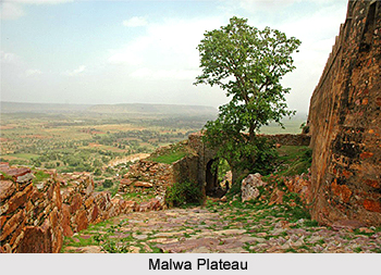 The highest peak of Dhar District, Mograba (751.03 metres) lies in the central part. Nilkanth (702.26 metres) lies further east and the Shikarpura hill rises up to 698.91 metres. The famous historical fort of Mandugarh towers the flat-topped hill about 600 metres, from the mean sea level. The northern half of Dhar District lies on the Malwa plateau. It covers the northern parts of Dhar, Sardarpur and Badnawar tehsils. The average elevation of the plateau is 500 metres above the mean sea level. The land is undulating with a few scattered flat topped hills roughly aligned between the valleys from south to north. The general slope is towards the north. The valleys are covered with black cotton soil of varying thickness, mostly adapted for cultivation. The mounds may bear gravels or the underlying sandstone rocks may have been exposed. The plateau covers an area of about 466,196 hectares in Dhar District.
Below the Vindhyachal scarps lies the narrow valley of the Narmada. It occupies the southern part of the district in Manawar tehsil and the south-eastern part of Kukshi tehsil. The width of the valley is 15 kms to 30 kilometres. The elevation varies from 275 metres in the northern part of Manawar tehsil to 150 metres in the low plain of Nisarpur in the south-west. To the east between Khalghat and Bakaner the valley is wider, more open and fertile with alluvial cover. Westwards of the valley is studded with hills alternatively cut up by numerous streams which join the Narmada along the southern boundary of Dhar District. The result is that there are few stretches and pockets of alluvium along the streams.
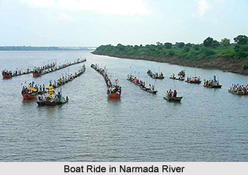
Geography of Dhar District also includes some major rivers and river systems. The southern part of the district lies in the catchments area of the Narmada River which forms the southern boundary. The north-eastern part is drained by Chambal River and its tributaries. It forms the catchment area of Ganga River. The north-western part drains into Mahi River. The water-dividing line between the Narmada and the Chambal and the Mahi are separated by the off-shoot range which runs along the Sardarpur-Jhabua boundary. The Narmada River flows along the southern boundary of Dhar District in a rift valley from east to west with a southerly inclination. It rises from the Amarkantak plateau of the Satpura Mountain Range in Shahdol district. It forms the southern boundary of Dhar District along with that of the west Nimar for about 107 kilometres.


